

Join devRant
Do all the things like
++ or -- rants, post your own rants, comment on others' rants and build your customized dev avatar
Sign Up
Pipeless API
From the creators of devRant, Pipeless lets you power real-time personalized recommendations and activity feeds using a simple API
Learn More


Related Rants


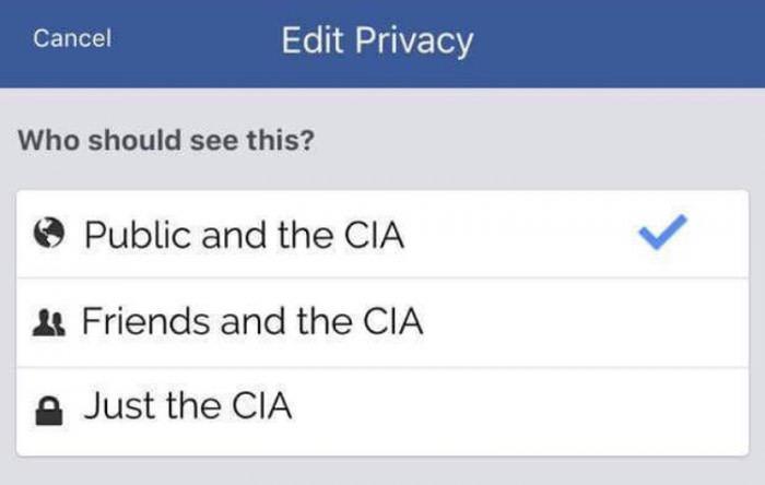 Privacy is a legend
I’m afraid I already know the answer to this question, but are there any navigation apps that aren’t powered by Google, etc?
Is there an alternative to Google/Apple Maps and Waze, that provides accurate information while also keeping user data (more) private?
question
privacy
gps
google is evil