Join devRant
Do all the things like
++ or -- rants, post your own rants, comment on others' rants and build your customized dev avatar
Sign Up
Pipeless API
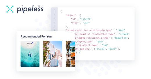
From the creators of devRant, Pipeless lets you power real-time personalized recommendations and activity feeds using a simple API
Learn More
-
My new phone will probs arrive tomorrow and me and mates are going on a vacation to Germany next week.
Currently using nearly all bandwidth/ram of one of my dedicated servers to download maps for offline use (OpenStreetMaps) and convert them to formats OsmAnd can use.
No need for google maps ❤️59 -
Finally fucking managed to setup quite fast map tile hosting including the tile generation after ages of research and trial and error.
I love this open (source) maps (openstreetmaps) project but man, figuring out what to do from a gazillion sources can be rather hard.
Now I'm just having some styling issues and the filesize is fucking insane (only the Netherlands with all data, 20gb+ if I remember correctly) so I'm just generating road maps for now. If someone knows some more about the styling as for the maps, please let me know!
Yeah, this is fucking satisfying.2 -
When I was 12 I created my own LEGO manuals and monopoly boardgame variants.
When I was 14 and into gaming I had fun playing with a Q3 level editor for Wolfenstein (GtkRadiant), and drew boardgame maps.
When I was 16 I translated the game battledawn.com to French for in-game currency in return.
When I was 18 I fiddled with texture packs for Minecraft and got interested in Total War mods.
When I was 20 I met a student who studied webdev & design. I was so excited about basic HTML, CSS and later JS and PHP, that I read and learnt some every evening (and even failed an exam because I was learning PHP until 5AM)
I always wanted to use my skills to create something of use to others. Open-source is the perfect avenue for that and is also what enabled me to get here in the first place. And though I m've been professionally employed as dev since 2015, only the last 2 yrs I finally consider myself skilled enough to give back something of quality :)2 -
The source engine is interesting, because it has reached that stage of life where it's old enough to be remarkable-- in the sense that it could be called 'legacy', a sort of milestone in development practices and thinking, both in software, and design.
That said, a better look at it might be from the lense of *uses today*.
A lot of former source engine (SE) devs are now going to unity or unreal, I don't blame them.
But it's interesting to examine examples of games that haven't.
One such game is the freeware "No More Room In Hell". A couple online play throughs shows a wealth of well designed maps (and an even greater horde of shovelware maps, but hey, you take the good with the bad).
The age of the engine itself shows. Even in games like Left 4 Dead the engine's age can be seen. This, in some respects has been a drag, but also a blessing. Where other games could rely on their effects, shaders, and other tech, modders, map makers, and designers have had to rely on wit and creativity.
Enter "situated environments."
In an age where many people desire to travel, to go places, and have grown up doing the exact OPPOSITE, there is a great desire for variety of locations in games: not merely 'environmental' in the shallow sense of a 'theme' such as 'lava', 'tundra', etc. But in the sense of setting in general.
We want places that are both out of reach and yet familiar. Fire-fights happen in city streets. Apocalypses happen in neighborhoods where the skyline is both broken and at once something we know by sight. Open air markets, grocery stores, neighborhoods, all of these provide the back drops of popular games and series such as COD, Battlefield, The Last of Us, and yes, the example game, NMRIH.
I call this idea of 'familiar but out-of-reach level design', "situated environments", because familiarity with them, but *lack of real life experience* with them, on a day to day basis, allows people's expectations to fill in the gaps.
No one for example would argue the layouts of 7 Days To Die are familiar, but most of us don't spend all day in a junkyard or a high rise hotel.
So they *feel* familiar. Likewise with Skyrim, the villages and towns, both iconic and strange, our expectations formed by cultural inheritance, hollywood films, television shows, stories, childrens books, and yes, other games.
In a way, familiarity-without-real-in-person-experience is a shortcut for designers, one that lets them play with the player's head-space, the players subconscious idea of how a space and setting *should* work, what to *expect* out of the area, how to *operate* within the area. And the more it conforms to expectations, the more surprising an overdesigned element appears to be, rather than immersion breaking. A real life example of this is people's idea of chernobyl. When they discover the amusement park and ferris wheel they're blown away by the juxtaposition of the wasteland that surrounds them and the associations ('nostalgia' as it were) that such a carnival ride carries for many of us. It simultaneously *doesn't belong* and is yet all at once *perfectly situated in the environment*.
It is to say 'surreal', which is adjacent to the idea of *being real*, in terms of our "perception of what is and isn't plausible, if not possible."
This is at the heart of suspension of disbelief, because in essence, virtual worlds are a lie, like fiction, and good fiction violates expectations in order to tell us truths about reality. As part of our ability to differentiate bullshit from reality, there is to say an element in our bullshit detectors (doubtless evolved over many 10's of thousands of years), that is designed to not merely detect what is absurd in our limited experience, but to incorporate absurdity into everyday experience. In that sense part of our rationality is the acceptance of irrational experiences, learning from it, and discovering 'a proper place for each thing' in the "models of the world" we all carry around in our heads. Eventually we normalize the absurd, it becomes the new reality, and what remains unassimilated becomes superstition (real or otherwise), a figment, or an anomaly.
One of the best examples I've encountered is The Last of Us: Left Behind, a good chunk of which is spent in a mall. And they nailed the environment perfectly I would say.
Or for those who don't own a PS4, a more accessible example is a map in NMRIH aptly called "the museum", and few words better do it justice than to go play it yourself--that is, if you really want to know what I mean by a 'situated environment'.
What better way, during this pandemic, to get out of the news cycle and into your own head? Sometimes the best way to escape isn't outside, it's within.3 -
Imagine an intelligent platform where creators are rewarded for launching and completing open source projects and groups of people teaming up to set up open source factories , implementing top level optimizations . There will ofcourse be judges who can earn a basic income from the platform as well . I don't want to go into too much details.
The platform could offer products as well with a modular backend . So for example this platform could have an mobile OS with a maps app on it . What the platform should do is adopt the best map algorithm to the application at certain intervals .
Product stays constant , open source power behind it changes and promotes competition .
Factories, products , space tech, open source labs which require certain reputation to get in ......
It's very ambitious but sounds like the way the future should take off . Companies and politics would be off picture down the line and maybe even terrorism will take a break . After all it's everyone together .
Oh and ofcourse it would have a search engine for sure.2 -
Data wrangling is messy
I'm doing the vegetation maps for the game today, maybe rivers if it all goes smoothly.
I could probably do it by hand, but theres something like 60-70 ecoregions to chart,
each with their own species, both fauna and flora. And each has an elevation range its
found at in real life, so I want to use the heightmap to dictate that. Who has time for that? It's a lot of manual work.
And the night prior I'm thinking "oh this will be easy."
yeah, no.
(Also why does Devrant have to mangle my line breaks? -_-)
Laid out the requirements, how I could go about it, and the more I look the more involved
it gets.
So what I think I'll do is automate it. I already automated some of the map extraction, so
I don't see why I shouldn't just go the distance.
Also it means, later on, when I have access to better, higher resolution geographic data, updating it will be a smoother process. And even though I'm only interested in flora at the moment, theres no reason I can't reuse the same system to extract fauna information.
Of course in-game design there are some things you'll want to fudge. When the players are exploring outside the rockies in a mountainous area, maybe I still want to spawn the occasional mountain lion as a mid-tier enemy, even though our survivor might be outside the cats natural habitat. This could even be the prelude to a task you have to do, go take care of a dangerous
creature outside its normal hunting range. And who knows why it is there? Wild fire? Hunted by something *more* dangerous? Poaching? Maybe a nuke plant exploded and drove all the wildlife from an adjoining region?
who knows.
Having the extraction mostly automated goes a long way to updating those lists down the road.
But for now, flora.
For deciding plants and other features of the terrain what I can do is:
* rewrite pixeltile to take file names as input,
* along with a series of colors as a key (which are put into a SET to check each pixel against)
* input each region, one at a time, as the key, and the heightmap as the source image
* output only the region in the heightmap that corresponds to the ecoregion in the key.
* write a function to extract the palette from the outputted heightmap. (is this really needed?)
* arrange colors on the bottom or side of the image by hand, along with (in text) the elevation in feet for reference.
For automating this entire process I can go one step further:
* Do this entire process with the key colors I already snagged by hand, outputting region IDs as the file names.
* setup selenium
* selenium opens a link related to each elevation-map of a specific biome, and saves the text links
(so I dont have to hand-open them)
* I'll save the species and text by hand (assuming elevation data isn't listed)
* once I have a list of species and other details, to save them to csv, or json, or another format
* I save the list of species as csv or json or another format.
* then selenium opens this list, opens wikipedia for each, one at a time, and searches the text for elevation
* selenium saves out the species name (or an "unknown") for the species, and elevation, to a text file, along with the biome ID, and maybe the elevation code (from the heightmap) as a number or a color (probably a number, simplifies changing the heightmap later on)
Having done all this, I can start to assign species types, specific world tiles. The outputs for each region act as reference.
The only problem with the existing biome map (you can see it below, its ugly) is that it has a lot of "inbetween" colors. Theres a few things I can do here. I can treat those as a "mixing" between regions, dictating the chance of one biome's plants or the other's spawning. This seems a little complicated and dependent on a scraped together standard rather than actual data. So I'm thinking instead what I'll do is I'll implement biome transitions in code, which makes more sense, and decouples it from relying on the underlaying data. also prevents species and terrain from generating in say, towns on the borders of region, where certain plants or terrain features would be unnatural. Part of what makes an ecoregion unique is that geography has lead to relative isolation and evolutionary development of each region (usually thanks to mountains, rivers, and large impassible expanses like deserts).
Maybe I'll stuff it all into a giant bson file or maybe sqlite. Don't know yet.
As an entry level programmer I may not know what I'm doing, and I may be supposed to be looking for a job, but that won't stop me from procrastinating.
Data wrangling is fun. 1
1 -
Question, how would you build the ultimate "I don't want to be dependent on Google or Facebooks services" setup?
IE, not using Gmail for e-mail, not using Google maps for, well, maps. Etc.
Im realy curious to see how the ultimate open source/not dependent on any big corporation harvesting userdata, ecosystem would look like. :)9


Top Tags
Weekly Rant
View