
Join devRant
Do all the things like
++ or -- rants, post your own rants, comment on others' rants and build your customized dev avatar
Sign Up
Pipeless API

From the creators of devRant, Pipeless lets you power real-time personalized recommendations and activity feeds using a simple API
Learn More
-
Hey everyone! As many of you have already seen, @trogus and I are happy to announce the release of devRant++, also know as the devRant supporter program!
devRant++ is a monthly subscription ($1.99 USD) that gives you some cool extra features while also contributing to covering some of our ever-increasing server costs.
Subscribers get:
- a badge that shows up on all of their rants and comments
- ability to edit rants and comments for up to 30 minutes (instead of the usual 5)
- ability to post unlimited collabs for free (so keep an eye out for new collabs, hopefully!)
- a reserved spot on the devRant++ supporter list (you can only move up higher or stay in the same position through the life of your subscription)
- more benefits coming soon!
Why did devRant++ come to be? Basically, we have the most awesome community members and we kept getting extremely generous requests from members asking how they could help devRant stay afloat. Instead of taking donations and not giving anything directly in return, we wanted to give supporters a little extra something to hopefully make the program kind of special.
We greatly appreciate everyone who has joined the supporter program so far. We also realize not everyone has the money to spend or wants to spend, and that's perfectly fine. We also greatly appreciate everyone here who posts great rants and comments, helps spread the word about devRant, votes on stuff, or is just a valuable member of the community in general. @trogus and I value all contributions and we want to make that clear!
Another reason we decided to go ahead with the program is, as I mentioned towards the beginning, our server/technology costs are increasing and we're kind of at a point where we can't afford all of the upgrades we'd like to make. At the same time while we need more hardware, we're trying to get the app to a place where we're not losing money every month, hopefully to the point where we can break even soon.
Anyway, thank you to everyone again for the amazing support and early interest in devRant++. We would love to hear feedback and stuff you would like to see added to supporter benefits, so just let us know! 60
60 -
devRant meetup in the Netherlands yesterday was awesome! Hereby a group picture we took.
Thanks for the amazing evening, people!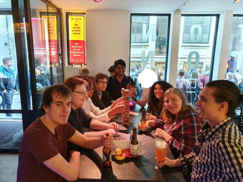 51
51 -
Wikipedia says that a nerd/geek lacks social skills. They should see this amazing community, thanks DevRant :)10
-
Finally I found the community where the developers feel happy, pity & LOL for each others delight and distress.
Thanks <devRant&&Co*in> 3
3 -
Got me some free swag. Thanks @dfox & @trogus! Might I suggest:
500++ stress ball
1000++ mouse mat
2000++ t-shirt
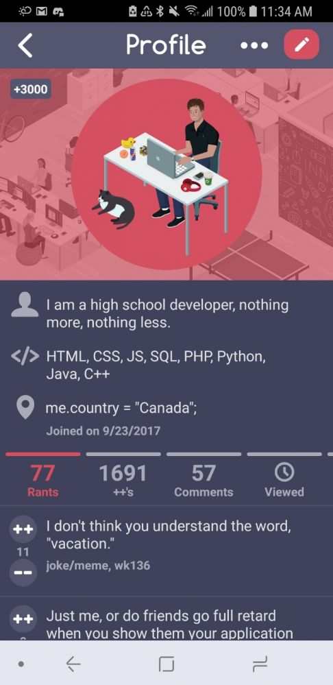
4000++ sexual favours
8000++ replacement soul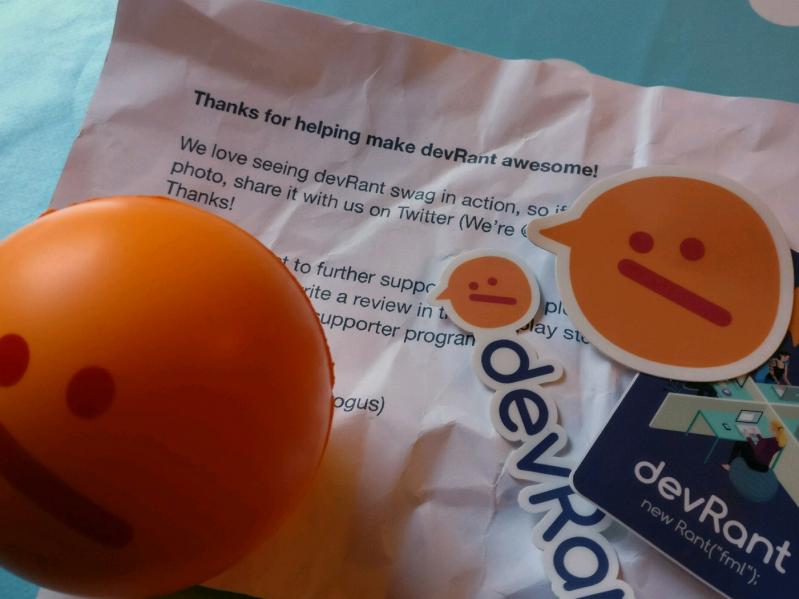 11
11 -
The fact that my wife thinks Devrant is lame is for me more confirmation that Devrant is the only social network for me worth spending time on. Thanks @dfox for making the world a better place for developers.2
-
The hour before i downloaded devRant i was a 9gager. Now i think i am devRanter.
Thanks dfox and trogus and all awesome people in this community. I am a fresh meat in dev world and here i learn so much things about real world i cant learn in anywhere. Cheers if you are reading.15 -
devRant was featured in a really awesome article on TNW (The Next Web). Please check it out and share it around. Thanks! http://thenextweb.com/apps/2016/...6
-
Hey everyone - apologies for the downtime earlier today. Our host is having a lot of issues and we're working to keep everything up through it.
On that note- there might be a little more down time tonight as they are trying to fix something and we might need a few server restarts. I will keep everyone updated and thanks for bearing with us!16 -
Since I discovered devRant, looks like I stopped using instagram, Facebook and Twitter.
I love this community so much!!
It even has functions facebook and instagram doesn’t have!
Thank you @dfox and all the others! Hope it continues like this!
Thanks devrant!6 -
This is to dfox and trogus. I think that a lot of devRanters are very happy with the support option! Although i hate Google pretty much i made a very unlikely exception for you because i would love to support the social network where i, next to being able to rant and be among fellow devs, met quite some very nice devs with whom i still am in touch with through slack and some encrypted channels. Thanks for this awesome place and I'm proud to be a supporter 😃7
-
Interviewer: So, we were researching you online and came across your devRant profile.
Me: Ok, I'll see myself out. Thanks.5 -
Devrant black theme is here! Thanks to @Floydian and @Stuxnet for the idea and the tag! You can also grayscale all images, for that late night devrant viewing.
https://github.com/7twin/...
Previous rant: https://devrant.com/rants/1554399/... 89
89 -
Just when I deactivated Facebook I found devrant. Hmm no regrets 😁 (thanks to Google play's homepage).4
-
After quit from Facebook and other social medias for 6 months, I think I found my place ! Thanks devRant !5
-
devRant has rose astronomically to become my favorite bathroom browsing material. Thanks for making poops that much better, everyone!6
-
Good luck to team devRant at the TNW NYC conference today. We are sure you will make our global devRant community proud as always. Thanks for all you do!
-
So i just wanted to say thank you. Everyone on devrant.
It became a safe place for me to rant about stuff, getting feedback from awesome people and so much more. Also i learned some things on dR that making my (dev)life better!
Most important devrant is making me feel way better, when you read about people having the same struggles.
But not only the rants are making this awesome. Its every single one of you.
Thank you, stay awesome!2 -
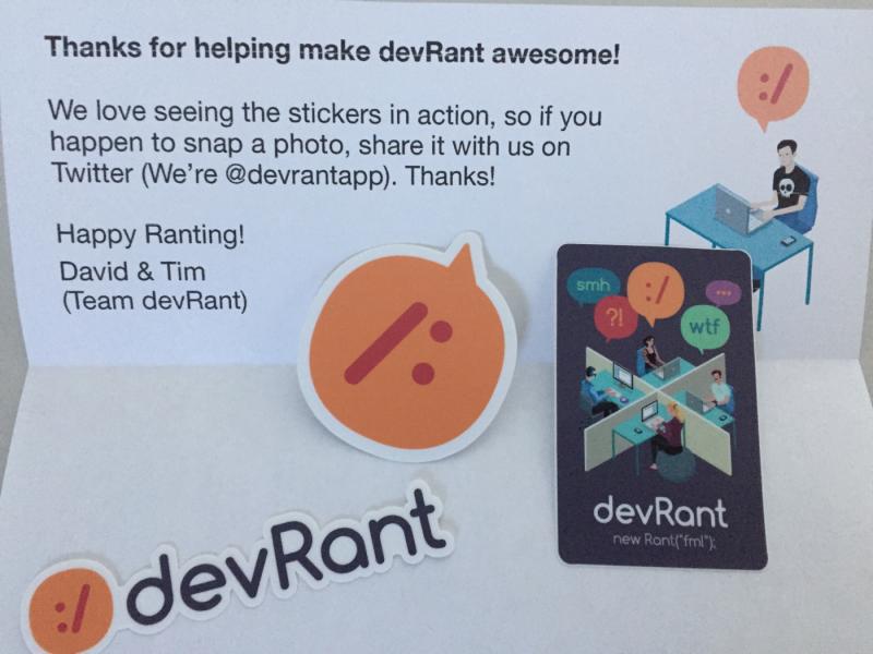
A special thanks to @dfox for the awesome swag that showed up today.
My daughter claimed the stress bar for her own. 7
7 -
Being bipolar sucks. Hypomania kicks you in the chin and your "realize" you're a shitty pprogrammer and your world is ending. Sometimes you get stickers from devRant thouch. mood++
Thanks devRant. 9
9 -
So guys and gurls...
I'm a member of devRant for about 1.5 weeks now. I already have over 130 likes on my rants in total about things I was never able to post without being labeled a nerd. I literally love you guys! Thanks to @dfox and @trogus for making it possible for us to discuss things that matter for us!6 -
I love you. I live devRant.
All I need sometimes is scrolling through your stuff, and I feel better.
Be safe, girls and guys. Be healthy, and stay here. #OneBigFamily ❤️9 -
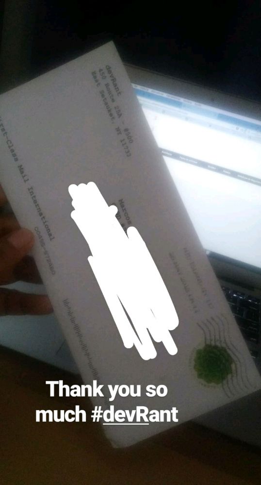
Received devRant stickers today. First international package. :D.
One of this stickers is going on my bike or bike helmet. For others, waiting for new laptop. Thanks David, Tim and team devRant from Mumbai, India. 13
13 -
First off: setup reveal
second off: thanks everyone for the 1000++!!
Lastly: devrant stickers!
Thanks @dfox and @trogus for making this awesome platform 10
10 -
Worth the wait. Thanks devRant. Thanks @dfox and @trogus.
The stickers travelled a long distance to reach here in India. 😄 4
4 -
Today is my devRant cake day! 🎂
Thanks everyone for making this community so great! This year on devRant has been so enlightening!1 -
I didn't expected that devrant could be this good, facebook is just full of spams nowadays and hard to find dedicated people. Thanks @condor for suggesting devrant16
-
The feeling, when you realize that devRant uses PHP as main language... priceless..
haters gonna hate :D
Thanks, @dfox7 -
Thanks for the stickers the devRant team and the app are awesome :)
Hope I can put the other stickers to good use too. 11
11 -
Working on a script that shows weather in a notification because why the hell not.
[edit] such compression much wow, thanks devrant 7
7 -
Thanks to DevRant, you have saved hundreds of monitors from getting smashed, keyboards from getting torn into pieces and mouses being flung across the rooms! There is a platform for rants now!3
-
100% honesty
I feel as if my friends from school are dropping me one by one and it's boiling down to my IT friends. I really like my friends and stuff but they're treating me like I'm invisible so I'm not posting this on instagram, not on twitter, and I'm not texting this to anyone, because I'm really starting to realize how big of an impact the life of IT studies has on me, and how amazing the community is. Thank each and every one of you for simply being here on devRant and I appreciate all of you.12 -
Well, devRant has turned me from a bigot arse into quite the humble and decent person, and on top of that, introduced me to some new series (well more so the users than the platform, but you know what I mean).
Binge watched Silicon Valley (season one, I just started) and learnt about dick to floor ratio.
Prior to that binge watched Mr Robot. Cannot remember who suggested that, so I cannot attribute the appropriate gratitude to the appropriate person here.
Add to that that I no longer claim one language to be holy amongst others. Yeah. I was that dick before, we all have a bad side. I'm just admitting it.
I sat down and started utilising other languages, and even found quite a few that did what I wanted more efficiently. Plus I have gotten to meet some sharp people and broaden my own mind.
Fuck I hate my job, but I see a fucking brilliant future for myself thanks to coding and the open mind that I have attained. I attribute this to devRant (perhaps it was lying dormant, but you guys awoke it.).
Enough chitty chat, I'm off to sleep and then code my balls off. 2
2 -
After a year of lurking on devRant I'm giving it the support it deserves.
- Awesome design
- Awesome community
- Awesome app
Thanks you devRant9 -
After waiting for more than 3 months....
(and devrant took 3 weeks...)
Thanks Ben & Jess
All kudos to dev.to() 4
4 -
This community is amazing. I started developing an app from scratch, with no knowledge of how to do it but this community has helped me so much. I have just started it, been a few days but devRant is what got me into coding in the first place. I was more of a hands-on electronics/mechanical engineering kinda guy but this has been amazing and I might just switch to computer science branch for my engineering. Thanks devRant and the community :)8
-
Looks great. That's all now set for my WhatsApp profile pic no more hassle on that. Thanks devRant for the awesome avarter.

-
I am also using devrant on my linux mint kde laptop...
https://github.com/Meadowcottage
(it's a unoffical app) its working fine :)
thanks Meadow_dev for making this.
Check this out guys :)
Thanks have a great day :) 16
16 -
So many stickers so little space..
But there is always place for devRant :D
Thanks @dfox and @trogus 7
7 -
Decided to stop lurking and sign up. Hi devRant. Thanks for all the sanity conservation you've provided me.2
-
I've been spending more time reading rants than working the past few days. Thanks for enabling my procrastination devRant! :)1
-
Finally I've got my stickers, thank you guys!!! Made my day *.*
(I told my classmates to join... ;) ) 3
3 -
This might seem insignificant, but I just hit 2000 ++'s!
Thanks everyone!
I think it shows how the community here appreciates each other, it's great 👍7 -
There's a devRant extension for Chrome & Firefox.
Please up vote this post so Edge users can too browse devRant in secrecy from there bosses!
Thanks 😁6 -
So the devRant stickers are finally here all the way from USA. Thanks devRant for these. Absofuckinglutely loved them. 😍
#devrant #developer #humour #android 1
1 -
Finally got my stickers! :D thanks DevRant, for being an awesome community. Keep up the good work!
 4
4 -
devRant keeps getting better and better! Collabs are great and the new avatar pets rock! Thanks devRant team.
What do you guys think of my new pets?2 -
devRant community is so awesome. I recently joined and everyone is so welcoming and friendly. Thanks! :)10
-
Breakfast && software engineering daily podcast && admiring my new stickers == a good start to the day
Thanks DevRant!
-
Turns out devrant is a school even for the experience because I just learnt something new today
FUCK YOU PAY ME!!!!
https://youtu.be/jVkLVRt6c1U
I love this, all thanks to devrant8 -
Wow! Updated devRant and - Custom Avatar Stickers in the store!! So cool. Just in time for the Holidays. Thanks team devRant😀😀😀3
-
Finally got my devRant Stickers!
Thanks David for fast delivery to Germany!
Hope you guys will remain successful!
-devRant rocks- 😎 1
1 -
The new devRant vote info is great! Improvements like this is one reason we all love devRant! Thanks devRant team for implementing this.
-
Wow!!! I just saw the new devRant upgrade in the App Store. Unbelievable new feature. Can't wait to setup tonite!!! Thanks @trogus @dfox !!!1
-
Me: *Showing the "You ! Count" image from devRant to a friend*
Friend: Haha! Nice one!
Me: You should install devRant, the image is from there
Friend: What is devRant?
Me: It's like Twitter, but only for programmers
Friend: No thanks, I don't like Twitter
I have failed you, master!2 -
Thanks Android 14. Now we have to install outdated apk's with adb and a flag 🙄. May apply to devRant too.17
-
Stickers arrived a couple of weeks ago ...but didn't managed to post a pic till now and to say thank you devRant. I love you all...keep the spirit.
 5
5 -
The new devRant long story feature is great! Very nice to have them in one place. Thanks devRant team!
-
I'm using my devrant avatar for some UI testing :P , thanks @trogus and @dfox
(no production and plagiarism intended) -
!rant
Thanks DevRant for sending these stickers to Singapore all be way from USA!!
Really lovin these stickers!! 1
1 -
I check whatsapp, facebook and devRant in that sequence because 0 notifications, 0 notifications ,2 ++s.
Am I being ignored or something by the lesser intellects of this planet? And thanks devRant for all the attention.7 -
// My first stickers is on! Let's collect
// them all! 😲
// #toBeStickerJunkie
//
// Thanks devRant 3
3 -
Wow! Just updated my devRant android and it has search! Opens the floodgates to data mining the rapidly growing content. Thanks!!!3
-
devRant mini rant... Only myself to blame
I wear flannels all the time :( but don't have 1000
Thanks devRant for awesome content, I will get the flannels soon!7 -
Thanks #dfox the Stickers and DEVRANT are awsome!<3
happy codeing and best Greetings from Hannover, Germany :-D 1
1 -
devRant Stickers arrived. One of them already found place on my MacBook :) Not sure where to put the others yet. Thanks @dfox
 2
2 -
I put my DevRant sticker on my phone's flip cover instead of on my laptop or cat.
Also thanks DevRant for the stickers! 3
3 -
Shout out to the devRant community, thanks David and Tim for the stickers. They arrived in The Netherlands.
 6
6 -
!rant, just asking the wise devRant community for advice:
What is a good laptop that works well with linux? Thanks in advance :)11 -
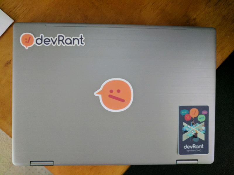
They will be the first stickers on my laptop. Thanks devRant for hours of fun in this great community!

-
When you need to buy a new notebook because the old one is full of stickers and your devrant stickers just arrived :-) Thanks!
 1
1 -
Got 'em stickers woohoo! All the way from Philippines. Letter got wet in the rain but the stickers are in good condition. Thanks devRant!
 4
4 -
Do you have a listing of the devRant open source projects - devRant slack bot, analyzer...?
Thanks1 -
Never hated or loved Microsoft.
After joining devRant, within 4 days I hate Microsoft more than ever. Thanks Guys. -
when you should be working but can't stop thinking about stickers and being self conscious about saying "lappy".. Thanks DevRant1
-
Just arrived love from NY and know London loves you back.
David and Tim, thanks for making devRant happen... this is awesome. 1
1 -
Wow! Giving Thanks this morning for the new devRant upgrade. Tag suggestions, links open in app, mute notifs... Thanks devRant team

-
thanks devrant :) my life is semi-complete :)
p.s. I'm so stressed I need a stress ball so badly ;)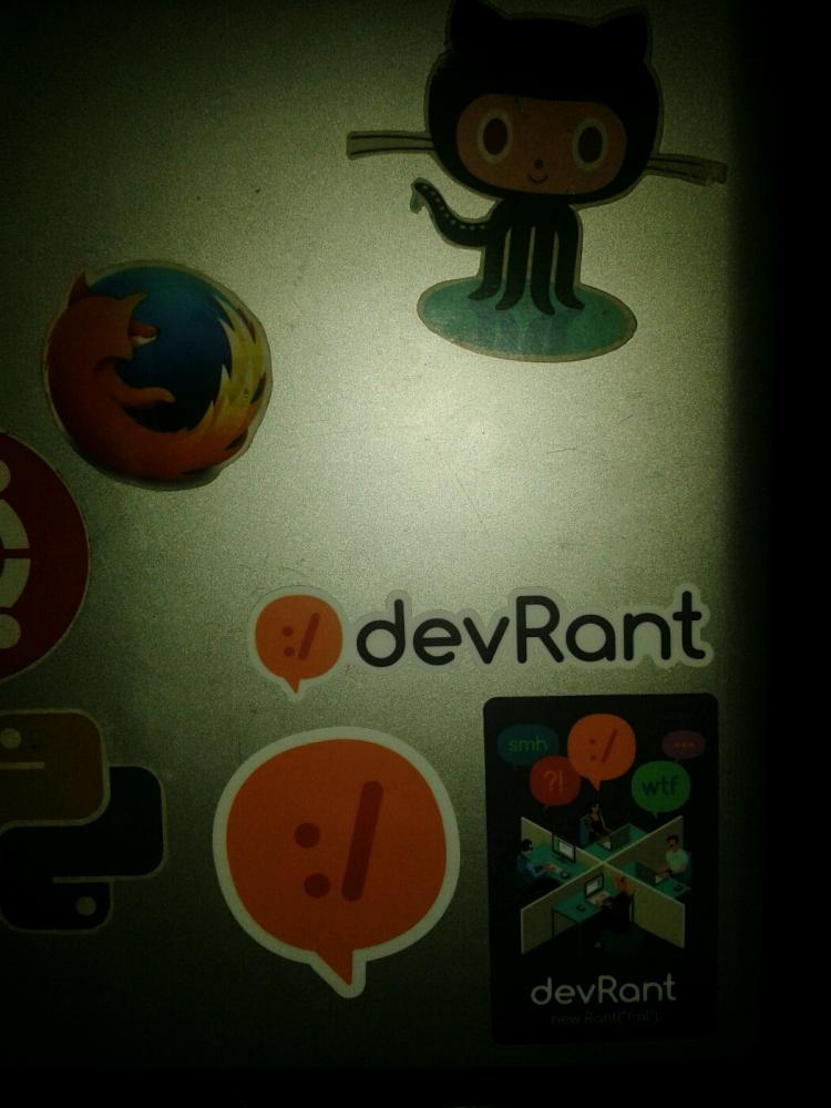 1
1 -
Have grown wierdly fond of devRant in a very short time.
Reading about devs around the world getting as frustrated and magnetically fucked as me, gives me some sort of sadistic calmness.1 -
The new devRant update and these stickers came in at the right time. haha thanks David and Tim. I really appreciate it!
 1
1 -
My stickers are finally here and I must say they are surprisingly high quality. Thanks a lot dfox and devrant community 🤘

-
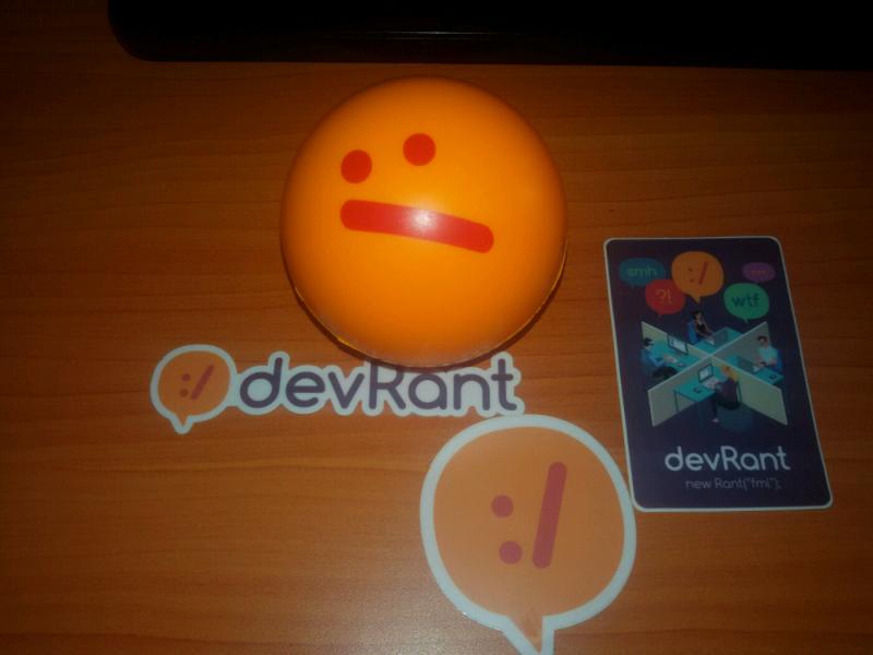
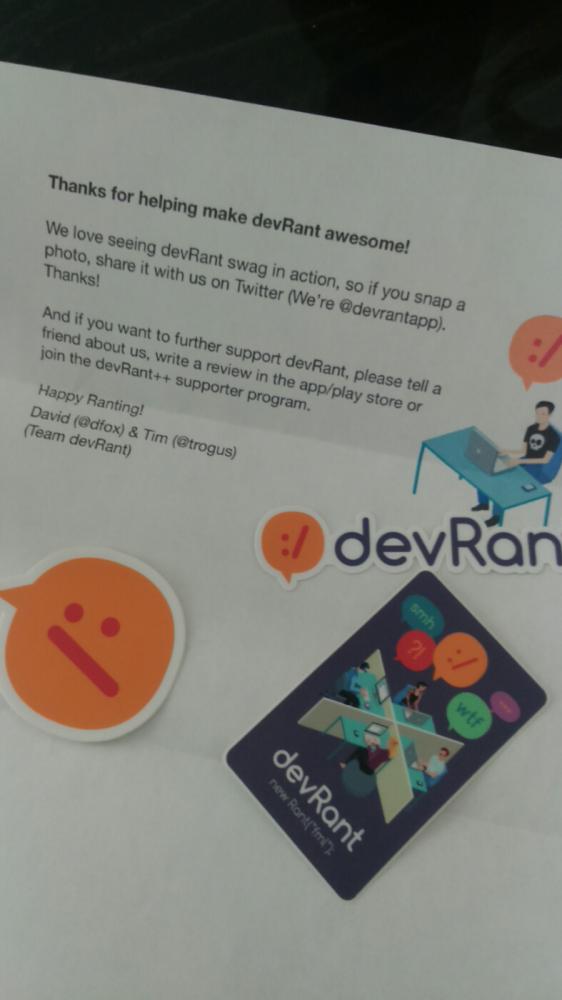
Just received my stickers and stress ball! A big thanks to the devRant Team. Keep up the awesome work!

-
Thanks thanks thanks devrant to not add theses useless story bubble shit in your apps like every other one7
-
Rant = false;
Thanks devRant for making me laugh and I honestly enjoy the discussions, the rants and the community as a whole!
Looking forward to continuing using this app and being part of this community!
-
!Rant coming to devrant after a month or so (sorry). Delighted to see all these changes :D :D. Thanks a lot @dfox @trogus
-
The devRant update is so great. So many of us love devRant and it keeps getting better and better. Thanks guys!
-
Thanks devRant for stickers, they're awesome, but I want to give a special thank to my brother, who opened mail, stickers left me on desk and rest threw away, so I don't know what was inside. 🤷♀️😂
 1
1 -
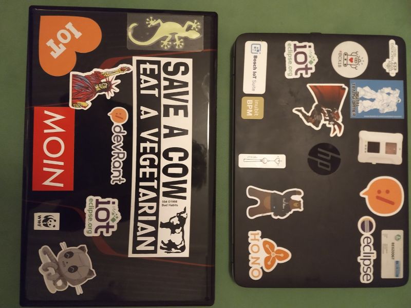
Finally got my stickers! Thanks devRant! Ready to start filling my laptop up with things only developers understand!
 7
7 -
Obligatory repost of @Skayo 's and @frogstair 's revamped API docs.
Thanks to our lords and saviours.
https://devrant.com/collabs/...2 -
If someone owns a OnePlus 5 I would be very pleased if you could try to reproduce this issue here:
https://github.com/devRant/devRant/...
Thanks a lot!6


Top Tags
Weekly Rant
View