Join devRant
Do all the things like
++ or -- rants, post your own rants, comment on others' rants and build your customized dev avatar
Sign Up
Pipeless API
From the creators of devRant, Pipeless lets you power real-time personalized recommendations and activity feeds using a simple API
Learn More
-
Things I've learned throughout my 5 - 6 years as a programmer.
- StackOverflow is full of assholes.
- CMS's are for weaklings.
- The best feeling about waking up in the morning is figuring out how to solve that error in your code.
- You no longer think about normal people things. Your mind is full of code.
- You're practically a computer.
- ALWAYS backup and save your stuff or you WILL regret it. Enable autosave if possible.
- RIP your social life (if your friends don't know squat about programming)
- Darkness is better.
- Being a programmer is amazing.25 -
29-year veteran here. Began programming professionally in 1990, writing BASIC applications for an 8-bit Apple II+ computer. Learned Pascal, C, Clipper, COBOL. Ironic side-story: back then, my university colleagues and I used to make fun of old COBOL programmers. Fortunately, I never had to actually work with the language, but the knowledge allowed me to qualify for a decent job position, back in '92.
For a while, I worked with an IBM mainframe, using REXX and EXEC2 scripting languages for the VM/SP operating system. Then I began programming for the web, wrote my first dynamic web applications with cgi-bin shell and Perl scripts. Used the little-known IBM Net.Data scripting language. I finally learned PHP and settled with it for many, many years.
I always wanted to be a programmer. As a kid I dreamed of being like Kevin Flynn, of TRON - create world famous videogames and live upstairs my own arcade place! Later on, at some point, I was disappointed, I questioned my skills, I thought I should do more, I let other people's expectations make feel bad. Then I finally realized I actually enjoy a quieter, simpler life. And I made peace with it.
I'm now like the old programmers I used to mock 30 years ago. There's so much shit inside my brain. And everything seems so damn complex these days. Frameworks, package managers, transpilers, layers and more layers of code. I try to keep up. And the more I learn, the more it seems I don't know.
Sometimes I feel tired. Yet, I still enjoy creating things and solving problems with programming. I still have fun learning. And after all these years, I learned to be proud of my work, even if it didn't turn out to be as glamorous as in the movies.30 -
A young Programmer and his Project Manager board a train headed through the mountains on its way to Wichita. They can find no place to sit except for two seats right across the aisle from a young woman and her grandmother. After a while, it is obvious that the young woman and the young programmer are interested in each other, because they are giving each other looks. Soon the train passes into a tunnel and it is pitch black. There is a sound of a kiss followed by the sound of a slap. When the train emerges from the tunnel, the four sit there without saying a word. The grandmother is thinking to herself, "It was very brash for that young man to kiss my granddaughter, but I'm glad she slapped him." The Project manager is sitting there thinking, "I didn't know the young tech was brave enough to kiss the girl, but I sure wish she hadn't missed him when she slapped me!" The young woman was sitting and thinking, "I'm glad the guy kissed me, but I wish my grandmother had not slapped him!" The young programmer sat there with a satisfied smile on his face. He thought to himself, "Life is good. How often does a guy have the chance to kiss a beautiful girl and slap his Project manager all at the same time!"3
-
If any programmer tells you that you are number 1 on his life, don't trust him.. most of us start counting from zero. haha3
-
The hardest part of being a programmer wasn't the education, the self-teaching, the sleepless nights or the hours of agony trying to fix a bug that would break a program I'd spend weeks working on.
It's the realization that my family, friends, coworkers...nobody understands at all what I do. They don't know of my failures or my triumphs. I can't talk about it with them and it's becoming more apparent to them that it's taking up more of my life. And in a way it feels like a part of myself has just become, well, alien.
Best way I can describe it is, it's like the "Tears in the Rain" scene from Blade Runner.
I'm stuck, I think. I know I've been shutting out people from my life more and more as I don't want to "deal" with people's issues, but I don't think it's been good. I'm can verify that I'm depressed beyond my normal levels.
It's time for me to make an appointment with a therapist.
Remember that you are loved here, and appreciated. Don't let anyone tell you different.
Stay strong. 25
25 -
FUCK YOU SHITTY FUCKING DICK HEAD!!!.. I'M FUCKING TIRED OF YOUR FUCKING BULLSHIT ABOUT "YOU'RE A PROGRAMMER... YOU MUST KNOW HOW TO USE PHOTOSHOP!"... OR "SUCH A SHITTY PROGRAMMER YOU ARE... DON'T YOU KNOW HOW TO FIX MY COMPUTER"... OR "CAN YOU MAKE ME AN APP?... IT'S LIKE OTHER APP BUT BETTER, I CAN'T GIVE YOU MORE DETAILS BECAUSE IT'S CONFIDENCIAL, SO YOU GOT TO DO IT WHIT OUT KNOWING WHAT THE FUCK YOU HAVE TO DO"... GO TO FUCK YOURSELF WITH A TRUCK FULL OF DONKEYS FUCKING IDIOT!!!... STOP TALKING BULLSHIT AND GET AND FUCKING LIFE YOU ASSHOLE!!!... sorry about my english for those who read25
-
Back in the days...
Parents: get off that computer it will get you nowhere in life!
Me:But im programming not playing games..I want to become a programmer...
Parents:programming or games it's all the same! Take an example of your sister who actually achieved something with her studies (she's a doctor)
Me today asa computer engineer...receiving paycheck higher than my sister who is a doctor and not to mention I got a car of the company and living very comfortably.
Parents can't believe it.
#rekt
Moral of the story: never let anyone tell you what to do. Keep doing what you truly love and get real good at it!😉12 -
When people say: "All you do is sit in front of your PC doing stuff. Get a life"
Me: This is my life!5 -
!rant
Programming is a huge blessing i believe we all should be thankful to. For me, it literally turned my life around.
11 months ago i was fighting a losing battle with depression, and contemplated suicide constantly. I would use a self remedy of smoking weed and sleeping all day long. I was depressed because i felt my life had no real value. I was doing nothing, and its kind of an infinite loop.
You don't do anything, so you feel bad, so you don't do anything, and so on.
That was until i finally took the step that changed my life. I searched and wanted to learn something. I always liked web pages so i thought id get into web development.
Did some research, found out that the fastest way to go was to learn ruby on rails. I followed a tutorial i found online, and literally pushed myself through it. There were times when there where things i didnt understand, and when it was really bad, but i pushed myself through it and i finished the tutorial.
Just finishing the tutorial and learning something new helped me alot. I had already quit smoking and was feeling way better, but after a while i started feeling bad again since i wasnt doing anything after i had finished learning, so i started working on a personal project, creating it from scratch, and just working on it day and night. I worked 14 hours a day, never really leaving my room ( this was during summer vacation ) for a month.
There were many things i didnt understand, but i never gave up and always searched for the solution and read about it until i understood it better. Looking back, there were things i knew could have been done in a better way, but as a first project, im proud of myself, not because it rocks, but because i did not give up.
In the process of starting a new life, i was really lonely. I cut all ties with everyone i knew, since they were all toxic, all i had in my life was ruby on rails and my web application. I wanted to launch it but couldn't due to personal reasons.
Not being able to launch and see something live, something that you worked so hard on, that you put so much effort into, that was devastating to me. I felt as if all my efforts had gone to waste.
And here is what i love most about programming, NOTHING EVER GOES TO WASTE. All that effort you spent on something ? All these all nighters you pulled ? All that frustration from that bug ? It will pay off later. It always does somehow. You get more knowledge and become a better programmer, and sometimes it even gives way to new opportunities and chances you never even expected.
I included my web application in my resume and it helped land me a job as a junior developer in a really nice company. A job that i wouldn't even have dreamed of several months earlier.
Programming and creating something new and learning something new everyday, creating something that people use, that someone else will benefit from and be grateful for, i think we should never take that for granted !
Tl;dr : learning how to code and web development saved my life8 -
*Stages of debugging*
1. That can't happen.
2. That doesn't happen on my machine
3. That shouldn't happen.
4. Why does that happen?
5. Oh, I see.
6. How did that ever work?3 -
Story of my life. Staying up all night to work on something that gets postponed or cancel
Source: http://commitstrip.com/en/2013/... 4
4 -
[This makes me sound really bad at first, please read the whole thing]
Back when I first started freelancing I worked for a client who ran a game server hosting company. My job was to improve their system for updating game servers. This was one of my first clients and I didn't dare to question the fact that he was getting me to work on the production environment as they didn't have a development one setup. I came to regret that decision when out of no where during the first test, files just start deleting. I panicked as one would and tried to stop the webserver it was running on but oh no, he hasn't given me access to any of that. I thought well shit, I might as well see where I fucked up since it was midnight for him and I wasn't able to get a hold of him. I looked at every single line hundreds of times trying to see why it would have started deleting files. I found no cause. Exhausted, (This was 6am by this point) I pretty much passed out. I woke up around 5 hours later with my face on my keyboard (I know you've all done that) only to see a good 30 messages from the client screaming at me. It turns out that during that time every single client's game server had been deleted. Before responding and begging for forgiveness, I decided to take another crack at finding the root of the problem. It wasn't my fault. I had found the cause! It turns out a previous programmer had a script that would run "rm -rf" + (insert file name here) on the old server files, only he had fucked up the line and it would run "rm -rf /". I have never felt more relieved in my life. This script had been disabled by the original programmer but the client had set it to run again so that I could remake the system. Now, I was never told about this specific script as it was for a game they didn't host anymore.
I realise this is getting very long so I'll speed it up a bit.
He didn't want to take the blame and said I added the code and it was all my fault. He told me I could be on live chat support for 3 months at his company or pay $10,000. Out of all of this I had at least made sure to document what I was doing and backup every single file before I touched them which managed to save my ass when it came to him threatening legal action. I showed him my proof which resulted in him trying to guilt trip me to work for him for free as he had lost about 80% of his clients. By this point I had been abused constantly for 4 weeks by this son of a bitch. As I was underage he had said that if we went to court he'd take my parents house and make them live on the street. So how does one respond? A simple "Fuck off you cunt" and a block.
That was over 8 years ago and I haven't heard from him since.
If you've made it this far, congrats, you deserve a cookie!6 -
I'm a lawyer, like a year ago I was home alone (wife and kid went on the trip) and from boringness, I decided that I should learn to program (was thinking about that earlier because of some ideas for apps I had - I was fucking naive then :P).
So I start googling best way to do it and I decided to start CS50 course on edx. And that was a real blast for. Best learning experience ever happened in my life.
Anyway, I was going through CS50 curriculum (at the start I thought I will quit it after few weeks) and every day was like so exciting. This whole programming thing seems like the best thing happens to me in many years. There were so many interesting things to learn, I felt like I discovered whole new word.
So after few months while I was finishing CS50, one day I decided, fuck it, this is what I want to do for the rest of my life (I'm 35+ btw ;)). I chose frontend path as it seems easier for a person without technical education. If everything goes as planned I will start looking for a job at beginning of next year. So where I the rant you could ask?
Well, you should guest what my family thinks about it. My wife was like at first: I'm proud you learning something new, now she hates it, making fights about me always sitting in front of computer (which is not true as I learn most in work in my spare time - I can do it as I work on my own), she even told my parents that I cheat her because she started family with a lawyer, not a programmer (supposed to be joke, but really not fun for me) . WTF - where is the fucking support ? ehhh. My parents on the other side still don't believe I will do it (after more than a year of my learning) and they still think I will quit the idea in the end....
So thats it my rant about what my familly thinks about me become programmer.
(sry for my English)20 -
Always at home: check
Dark themes ftw: check
Black hoodie: check
At least 2 monitors: check
1k Browser tabs: check
Up all night: check
Tiered 24/7: check
notepad++: check
Keyboard wakes my sister from 2 rooms across: check
Burns in sunlight: check
DevRant: check
What else to be a successful programmer?28 -
Jesus and Satan have an argument as to who is the better programmer. This goes on for a few hours until they come to an agreement to hold a contest with God as the judge. They set themselves before their computers and begin. They type furiously, lines of code streaming up the screen, for several hours straight.
Seconds before the end of the competition, a bolt of lightning strikes, taking out the electricity. Moments later, the power is restored, and God announces that the contest is over. He asks Satan to show his work. Visibly upset, Satan cries and says, “I have nothing. I lost it all when the power went out.”
“Very well,” says God, “let us see if Jesus has fared any better.”
Jesus presses a key, and the screen comes to life in vivid display, the voices of an angelic choir pour forth from the speakers.
Satan is astonished. He stutters, “B-b-but how?! I lost everything, yet Jesus’ program is intact! How did he do it?”
God chuckles, “Everybody knows… Jesus saves.”4 -
I am a hobby programmer. I just got rejected by the biggest crush of my life. I guess I'm stuck with my stupid wothless fucking life writing code. How fucking exciting....21
-
How did I learn programming?
When I joined college I was literally the dumbest in the class... I didn't even know what is a char and what is a String.. Our lecturer made fun of and humiliated me in front of the whole class....also my parents barely afforded my college tutotion fed...
So one night I sat with myself and reevaluated myself and decided that no matter how hard it is gonna be, I must become an excellent programmer....spent restless nights and days learning the core of programming in c++ then switched to Java *best day in my life* and also learned Android development.. And later JavaScript "mostly worked with jQuery and AngularJs*
In my final year project I built an Android web browser that even the lecturer that made fun of me was impressed by..and my app was rated the best project of that batch.
Now I'm working as a Java web dev and made a promise to myself that I'd learn something new every day.8 -
"Just about every aspect of your every day life is run by or depends on millions of lines of code.. have you hugged a programmer today?"1
-
I JUST FINISHED MY FIRST NEURAL NETWORK!!!
But first of all, as I know you guys, it's spaghetti code and even I as a newb see places where I used too few-dimensional array or passed useless parameters or simply wrote too many redundant lines of code. I know it. I will make it MUCH better next time. Period.
But OMFG this made me scream from happiness today!! Just these few seemingly random numbers... I'm really done.. That's why I jumped into coding year or two ago..
And for some background, I didn't study any IT school, I'm just highschooler (general grammar school) who traded gaming for learning. Also my maths teacher teached NNs on university and is very keen to teach me, so that's that.
Now I wanna make the best out of it and I'm looking forward to write some well documented and flexible library, parallelized and everything (I'm gonna learn a lot in the process of doing this) better then FANN.
Maybe I'm gonna fail(99% probability but hey, I'm programmer beginner, I still think I can code everything I want). But if there is just one moment like when I saw this screen today, I'mma trade my life for it.
Sorry for taking your time guys, I was just genuinely stunned... A lot 24
24 -
It wasn't my curiosity that introduced me to programming. Actually, it was my mother.
It was about six years ago, when I'd told her I'd like to make video-games, like all kids do. She didn't just nod and go about her way. She found a free course that taught programming to kids my age and immediately enrolled me. Looking back, it was surely the best thing she'd done for me, because it gave me a purpose and a future to look forward to.
The course was interesting. We learned the basics of C++, then moved on to harder topics like algorithms and data types. But more and more, I was beginning to feel left behind. Like I didn't belong there. It didn't help that I only programmed on the course, with no practice back home.
I felt scared of the future. Thought I didn't have what it takes to become a programmer. I might have broken the last straw when I started playing truant and went to McDonald's to pass the time. Because every time I did go to the course, I felt stupid and anxious. So I simply skipped.
Time passed. I got more depressed, became more antisocial, my self-esteem took a nosedive. And when it comes to depression, people always seek an escape path.
I got my escape in fiction. Started reading books, tried writing stories, and it got to the point where I asked my mother if I could become a writer and not a programmer.
And guess what? She said, "Do what brings you happiness. This is your life."
It's funny, that such a silly line stopped and got me to think. Turned out, I didn't program for fun, for myself or for my career. I'd done it for my parents, for their expectations and I was scared that in failing, I'd become a loser in their eyes.
I dropped out of the programming course. Not because it sucked, but because I wasn't going there for myself, but for my parents. But I didn't quit programming. No, I watched countless tutorials, youtube videos, browsed StackOverflow, read some books, coded every day, and now I can say without hesitation, that I love programming. I'm hooked. And I don't want to stop.
If you've read this so far, I'm sorry for my rambling. I will now leave you with only one tip: If you decided to do something, do it for yourself. Forget about parents, expectations, career, future, time or money and do it only because you want to. Because nothing else matters. Only your happiness.7 -
The Absolutely True Story of a Real Programmer Who Never Learned C.
I have a young friend named Sam who is quite a programming prodigy. Sam does know C! I need to make this clear: he’s not the titular programmer.
But a couple years ago Sam told me a story about a different programmer who never learned C, and I liked it so much that right on the spot I asked his permission to repeat it. (I could never just steal such a tale.)
Sam wasn’t always a programmer—actually he started in his later teens, in part because he was more of a jock, and in part because he was related to programmers and wanted to do his own thing. But, like all great programmers, once he was bitten by the bug he immersed himself completely in it.
One day Sam happened to be talking programming with his uncle, who was also a programmer but from way, way back.
“Hey,” said Sam, “I’m learning this language called C. You must know a lot of languages, did you ever study C?”
“No,” said the uncle, to Sam’s surprise. “I am one of the very few programmers who never had to learn C.”
“Because I wrote it.”
Oh, Sam’s last name is Ritchie.
What I love about this story is the idea of Dennis waiting Sam’s entire life to deliver this zinger. Just imagine sitting on a line that good, watching your nephew grow up and waiting, waiting until the one day he finally starts learning to code. Did he work on the line in his head at night? Like, “Hmm, how should I word it so I can deliver the punch line perfectly? Should I say ‘I never took a class on C?’ Nah, too awkward…”
The great thing about geniuses is how much effort they put into everything.
Courtesy : Wil Shiply.5 -
If I run into a problem with code or a configuration of some kind, like a good little programmer, I Google it.
One of two things will happen:
1) I quickly find the answer to my problem.
or
2) After hours of searching, I can't find anything about my problem. At all. I change the search phrasing, adjust the advanced search settings, read all the somewhat related but still unrelated articles. Nothing.
If #1 happens, awesome, life is great, thanks Internet!
If #2 happens, it's because of one of two things:
1) I am the first person in the world to stumble upon this issue. Quick! To the Blog Cave!
2) I AM TOO STUPID TO BE DOING WHAT I AM TRYING TO DO BECAUSE MY MISTAKE IS SO UNBELIEVABLY DUMB THAT NO ONE HAS BOTHERED NOR WILL BOTHER TO WRITE ABOUT IT, ANYWHERE, EVER. I LOOK AT MY WORK AGAIN FOR THE 100TH TIME AND FINALLY REALIZE MY EMBARRASSING NOOBERY.
2.1 is a unicorn. 2.1's happen to other people.
I am dealing with a 2.2.2 -
My first poem for programmer girl 😘😘😘
My life is incomplete without you,
You are semicolon of my life
You are my increment operator,
you make my value increases
I am username and you are my password,
without you No one can access me
You are my initializer,
without you my life would point to nothing (NULL or “0”)
If I were a function you must be my parameter,
Because I will always need you
Can you be my private variable?
I want to be only one who can access you
You are my compiler,
My life wouldn’t start without you
You are my loop condition ,
I keep coming back to you
My love to you is like recursive function,
It will never ends & Will never enter into infinite loop
Forever and Ever10 -
So this is Reddit with a slick design specifically for complaining about how life as a programmer is annoying some of the time? I'm in.3
-
*Moves to another town to start a new job
*Been living in a dorm for the past month
*Starts looking for flats to rent
*Misses a few nice ones because he finds their ads a few hours late
*Starts developing an app that looks for new flat ads that matches his requirements and notifies him of their existence
*Finds a nice flat by accident before he even finish developing the app
*Refuses to rent it only because he believes his app could do better!
Me in a nutshell!4 -
We had a client visit our PH office to "hang out" and see the progress in this educational type game we were building for their private school (apparently, it's the one that Obama's kids went to).
Manager oversold the progress and actually guaranteed some features that we were still working on and estimated to finish in the next 3 sprints (2 week intervals).
Client was due to be in the office in 2 days.
PM pushes back and says we need to manage client expectations properly.
CEO got wind and sat the dev team down. Dev lead, two seniors, and junior me. He sat us down and asked us what we think.
Lead says we can do it.
Now to be fair, I know this guy to be very competent and an INCREDIBLE programmer. He is the person I consider to be the first real mentor I ever had but I really thought we were fucked here.
Next day and half was hell--for me, at least and I really couldn't see how this was all possible.
But then the fucker came through. This beautiful, majestic meganerd and the two other guys shat out 6 weeks of code in ~30 hours.
And the crazy part was it was all working. Bugs were caught in the next few days for sure, but the demo went flawlessly.
I never doubted this guy again.
Years later, I'd meet up with him and would talk fondly about those days and all he could say was "I don't really remember". He remembers the project and that we had a demo but he couldn't remember anything around those days.
Two of the most stressful days of my life and to him it was a fucking Wednesday. What a fucking champ.4 -
On June 2016, I've quite my job. 15 years as developer/system administrator in a middle company in switzerland. 30 people with everyday problem. 30 calls per day.
Now, i work in my own company.
More work, no more time, but u know what? No regrets!! I'm freeeeeeee! :p3 -
!warning could be longer.
I must something let go:
Im now 24 ,my life was not easy .
I got bullied all the time in school from 1 to 10 degree. I had a dream since i was 6:"no i dont wanna be a police man, fire fighter, astronaut....i want to be a programmer "..
My father did me to make an apprenticeship with Volkswagen after i finished my "middle school" (10th class);
2 years of mobbing and be sad i leaved that motherfucking "-aship"
After a while my father again wanted to ,i must to an "-aship" .yeah hes been right, but i dont want to do and work like you do!!!.. then again after "fighting" my dad (parents), i was reliant to social help for a year..
(U must know,my dream was always in my mind)
I met a girl in a different federal state in germany and moved up to her.
I worked as a daywage man to get us money.
1 year was over and then i found out the apprenticeship as web and mobile developer (computer scientist) . I applied for this an got a place.
Now my fucking dream comes true in a few months!
Just wanna say that you never should give up your interests or dreams, doesnt matter how old you are!!!!
My journey begins 2017 and yours?:))))5 -
!rant
Some of my friends and me stayed the night in a small house. Everyone except me drank beer and now they are all sleeping while I am sitting right next to the socket in a corner listening to music and reading through the documentation of java.
This describes my life pretty well. -
Uninstalled Whatsapp
Uninstalled Facebook
Uninstalled Instagram
Uninstalled Twitter
Don't use Snapchat
Didn't uninstall DevRant😁
Coz it is resourceful and fruitful conversations are not worth to be missed even during exam time!
Exams got me like this 😣
Btw Which social apps do you use on daily basis ? Just curious to know 😅43 -
My mother is the one that introduced me to computers from a young age. She would tell me that they were the future and that people could do amazing things with them. Fast forward at me graduating from uni with a B.S in Computer science and she was the happiest :) she tells everyone that I am a computer scientist, she seldom says "programmer" or "developer". She is super well versed in general computing and can use Linux and Mac, so yeah :) mom is awesome. My dad has lil idea of what I do, to him its just magic, my step dad is the same way but he will be the first to tell everyone that I am a wizard.
My brother and sister could care less...my sister tells everyone that I am the smartest person she knows, but that I spend most of my time glued to the screen "playing with a bunch of weird code!"
The rest of my family is pretty meh about it, 2 of my uncles are super proud of it and normally ask for my input regarding tech or about life as a dev.
Finally, the wife. The wife knows how to code from before I even knew what code was :) so she knows exactly what I do :)8 -
Hey DevRant!
I've been lurking for a few weeks now, and it bothered me that I couldn't like/dislike posts, so I finally decided to make an account. :D
I am currently a programming student, I'm in my third year. I started learning with C# but later I switched to Python, PHP and HTML5.
There's still many things I want to learn, this is just the beginning of my long, stressful yet rewarding life as a programmer. (:12 -
How to make your employee suffer, drive them insane and having suicide tendency 101.
Delay the paycheck for 18 days but still asking about task progress like a normal day. Like nothing happened.
I can't pay water and electricity bills that due in 3 days, can't buy medicine,
can't buy gas for the bike,
next week i'm not gonna be able to buy food
The good thing is, i still got the internet, i can look for new jobs and play some games to forget how shit my life right now while the electricity lasts.
Disclaimer
I have no suicide tendency, just to make it more hiperbolic 🤣8 -
Here's a genuine rant for you. Probably the only one I've ever made and ever will..
It's a bit depressing and covers a few topics so just read it, it's important.
*deep inhale*
So, with the help of my friend and my Nana, I was getting VR set up. (Oh, what joy.)
Now, I love everything about VR. But the thing is, I've had this damned headset since may (Dell MMR) and I haven't been able to use it. The reason for that is, something always came up that I needed to buy and this became a huge deal.
But let's start from the beginning.. I'm curentally fighting depression. I have been for months. My only income is what my Nana gives me ($150/mo) and what my friend ocasinally gives me.
Anyways, the first issue was that I couldn't afford the headset. This was find, as my friend would get it for me, and I would pay them back the following month. But, then, once I got the headset that's when the real problems started. First it was that I needed bluetooth, so I bought an adapter. Then I realized my entire CPU was incompatable, so I had to get a new tower and I went ahead and got a new GPU as well. I also got a charging kit for my headset (This ended up making me owe my Nana money). Then after all of that was settled, I learned that the evauation software lied, and my computer doesn't have USB 3, so I need that too but low and behold; both of my graphics cards cover my second pcie slot. So my options are to either try and rig up something, or to buy a cpu and psu for my third AMD PC which I had forgotten about during this whole ordeal..
This was soposed to help me with my depression and stress. Now I don't even want to get out of bed.
With all that said, I might be getting on SSI soon (I'm sure some of you are familar with that, and no I don't want to talk about it) and when that happens I might just leave behind tech (well, my PC and games) and all the stress and pain it's caused me over my life so this was all for nothing.
Honestly.. I'm just done with everything. To all the new faces around here; Hello! How are ya? To everyone else; You know me. I've been around for a while, though I'm not popular because I lurked and commented with Alice. You all probably noticed that I left a while back, and it was because I was trying to get out of tech. My reason for tech was that I was searching for something. I was always looking for the next game to sate me, or fill this gap in my life. I became a programmer because it gave me control were I lacked it otherwise. I made friends online because my anxiety prevented me from doing so in the real world.
But to what end? What have I acomplished? My twenty second birthday is next month. I've no job, I move from family member to famly member because I'm so fixated on becoming someone else to make something of myself.
I have my own ideals, but it seems that I push them aside to try (and fail to) impress others.
It's time for change. Of course, I can't do anything without money, so I'll have to wait for my SSI which I will get news on in August.
I hope this message came through how I meant it to. There is so much I want to say, but I've no words to say them. And btw, the VR thing is just one of manny issue that i've delt with (but certanly the most expensive)
Alice, Zennoe (Alexis, whom is not on devrant); I'm not giving up tech entirely. don't expect to suddenly not hear from me. I'm mostly just giving up my computer and games. More casually so for now, and them more seriously once I get on SSI. I'll still message you every/other day like I have been. <326 -
Programmer Influencers piss me off to Jupiter and back.
The ones who talk about just being a programmer, and don't do normal tutorials and solve a real-world problem and demonstrate it.
"i iNcREaSeD mY pRoDuCTiViTy bY 90%. hErE's HoW"
"tOp 10 lAnGuAGeS yOu sHoUlD lEaRn iN 2023"
"dAy iN thE LiFe oF a SoFtWaRe EnGiNeEr"
"HeRE's hOw yOu cAn wRiTe bUg fReE cOdE"9 -
I've caught the efficiency bug.
I recently started a minimum wage job to get my life back in order after a failed 2 year project (post mortem: next time bring more cash for a longer runway)
I've noticed this thing I do at every job, where I see inefficiency and I think "how can I use technology to automate myself out of this job?"
My first ever application was in C++ for college (a BASIC interpreter) and it's been so long I've since forgotten the language.
But after a while every language starts to look like every other language, and you start to wonder if maybe the reason you never seriously went anywhere as a programmer was because you never really were cut out for it.
Code monkey, sure. Programmer? Dunno, maybe I just suffer from imposter syndrome.
So a few years back I worked at a retail chain. Nothing as big as walmart, but they have well over 10k store locations. They had two IBM handscanners per store, old grungy ugly things, and one of these machines would inevitably be broken, lost or in need of upgrade/replacement about once a year, per location. District manager, who I hit it off with, and made a point of building report with, told me they were paying something like $1500 a piece.
After a programming dry spell, I picked up 'coding' with MIT app inventor. Built a 'mostly complete' inventory management app over the course of a month, and waited for the right time.
The day of a big store audit, (and the day before a multi-regional meeting), I made sure I was in-store at the same time as my district manager, so he could 'stumble upon' me working, scanning in and pricing items into the app.
Naturally he asked about it, and I had the numbers, the print outs, and the app itself to show him. He seemed impressed by what amounted to a code monkeys 'non-code' solution for a problem they had.
Long story short, he does what I expected, runs it by the other regionals and middle executives at the meeting, and six months later they had invested in a full blown in house app, cutting IBM out of the mix I presume.
From what I understand they now use the app throughout the entire store chain.
So if you work at IBM, sorry, that contract you lost for handscanners at 10k+ stores? Yeah that was my fault (and MIT app inventor).
They say software is 'eating the world' but it really goes to show, for a lot of 'almost coders' and 'code monkeys' half our problem is dealing with setup and platform boilerplate. I think in the future that a lot of jobs are either going to be created or destroyed thanks to better 'low code' solutions, and it seems to be a big potential future market.
In the mean while I've realized, while working on side projects, that maybe I can do this after all, and taken up Kotlin. I want to do a couple of apps for efficiency and store tracking at my current employer to see if I'm capable and not just an mit app-inventor codemonkey after all.
I'm hoping, by demonstrating what I can do, I can use that as a springboard into an internal programming position at my current gig (which seems to be a company thats moving towards a more tech oriented approach to efficiency and management). Also watching money walk out the door due to inefficiency kinda pisses me off, and the thought of fixing those issues sounds really interesting. At the end of the day I just like learning new technologies, and maybe this is all just an excuse to pick up something new after spending so long on less serious work.
I still have a ways to go, but the prospect of working on B2B, and being able to offer technological solutions to common and recurring business needs excites the hell out of me..as cringy and over-repeated as that may sound.7 -
Installed elementaryOS on one of antique PCs at work (language school) because it was struggling with Windows 8...
Convinced the boss to put Linux on his own computer.
Today, the colleague for whom I did this told me that she said to one of her students that some programmer (Meeee 😀) told her to stop using some stupid unsecured local mail providers and to use ProtonMail.
Was very proud... Why life not like this everyday.3 -
Fuuuccckkkk! I just realised I made 120 commits over the past 100 hours.
It's a big thing for me as a developer and open source enthusiast because I finally understood how to work on open source projects with a team and also I've been able to give equal time to all my current projects.
Also, GitHub going green is a beautiful feeling xD
So proud of myself lol 1
1 -
I spent 5 years as sole programmer on a Doom 3 total conversion. Joined the team as a shitty C programmer that didn't know C++, and just hit the books and got rid of the social life. The successful part is that we actually finished it.
It's just a game mod and my fist foray onto a new language, and current project will hopefully soon replace it as my biggest & best show of skill, but I'm still proud of it.3 -
Jesus and Satan have an argument as to who is the better programmer. This goes on for a few hours until they come to an agreement to hold a contest with God as the judge. They set themselves before their computers and begin. They type furiously, lines of code streaming up the screen, for several hours straight.
Seconds before the end of the competition, a bolt of lightning strikes, taking out the electricity. Moments later, the power is restored, and God announces that the contest is over. He asks Satan to show his work. Visibly upset, Satan cries and says, "I have nothing. I lost it all when the power went out."
"Very well," says God, "let us see if Jesus has fared any better."
Jesus presses a key, and the screen comes to life in vivid display, the voices of an angelic choir pour forth from the speakers.
Satan is astonished. He stutters, "B-b-but how?! I lost everything, yet Jesus' program is intact! How did he do it?"
God chuckles, "Everybody knows... Jesus saves."2 -
More of a question than a rant. What to do regarding programming.
I'm self taught, php, c, c#, and I make stupid little programs that make my life easier as a sys admin.
I want to ask, how do I take things further? Where I'm from, it's really hard to get a job as a programmer without 5 years experience and knowledge in 5 other languages.
Do I try and make bigger apps to showcase myself and hope someone finds me, or what do I do in this instance. I'm not a fully fledged coder, but I'm comfortable and if I don't know something i learn it pretty quickly.
Is there a way that you get a job, even as a junior? Or is it pure luck? 10
10 -
Usually, when I'm in the mood to code, my GF will tease me by sending a lot of text messages at once.
When I'm not in the mood, she had slept earlier :-|3 -
Over 7 years writing software, through good, bad and ugly.
I still wake up feeling like an impostor most of the days.
Impostor syndrome on fleek.4 -
So, my last rant here was 3 years ago, and i just signed in again to devrant to post this fucking shit.
There is this guy who is a Project Manager in my office, I haven´t work with him but he sits in front of me and i have to listen to his bullshit almost every fucking day. Anyways, the other day he was talking to some other guy (a PM, also) and he said something like this:
"Programming is the most overrated thing ever, everyone can do it, you could do it, i could do it just googling stuff, i could even replace almost every programmer in this office, it´s the easiest thing ever. a programmer couldn´t do my job even if his life depended on it ´cause they can´t talk, they can´t manage people, they can´t manage their own time, heck they can´t even manage to talk to each other. they´re just a bunch of incels who think they´re important and their job is shit anyway".
They don´t see us as human begins, they see us as necessary evil.
(apologize if i wrote something wrong. English is not my first language)7 -
I've recently received another invitation to Google's Foobar challenges.
A while ago someone here on devRant (which I believe works at Google, and whose support I deeply appreciate) sent me a couple of links to it too. Unfortunately back then I didn't take the time to learn the programming languages (Python or Java) that Google requires for these challenges. This time I'm putting everything on Python, as it's the easiest language to learn when coming from Bash.
But at the end of the day.. I am a sysadmin, not a developer. I don't know a single thing about either of these languages. Yet I can't take these challenges as the sysadmin I am. Instead, I have to learn a new language which chances are I'll never need again outside of some HR dickhead's interview with lateral thinking questions and whiteboard programming, probably prohibited from using Google search like every sane programmer and/or sysadmin would for practical challenges that actually occur in real life.
I don't want to do that. Google is a once in a lifetime opportunity, I get that. Many people would probably even steal that foobar link from me if they could. But I don't think that for me it's the right thing to do. Google has made a serious difference by actually challenging developers with practical scenarios, and that's vastly superior to whatever a HR person at any other company could cobble together for an interview. But there's one thing that they don't seem to realize. A company like Google consists of more than just developers. Not only that, it probably consists - even within their developer circles - of more than just Python and Java developers. If any company would know about languages that are more optimized such as C, it would be Google that has to leverage this performance in order to be able to deliver their services.
I'll be frank here. Foobar has its own issues that I don't like. But if Google were a nice company, I'd go for it all the way nonetheless - after all, they are arguably the single biggest tech company in the world, and the tech industry itself is one of the biggest ones in the world nowadays. It's safe to say that there's likely no opportunity like working at Google. But I don't think it's the right thing. Even if I did know Python or Java... Even if I did. I don't like Google's business decisions.
I've recently flashed my OnePlus 6T with LineageOS. It's now completely Google-free, except for a stock Yalp account (that I'm too afraid to replace with my actual Google account because oh dear, third-party app stores, oh dear that could damage our business and has to be made highly illegal!1!). My contacts on that phone are are all gone. They're all stored on a Google server somewhere (except for some like @linuxxx' that I consciously stored on device storage and thus lost a while back), waiting for me to log back in and sync them back. I've never asked for this. If Google explicitly told me that they'd sync all my contacts to my Google account and offer feasible alternatives, I'd probably given more priority to building a CalDAV and CardDAV server of my own. Because I do have the skills and desire to maintain that myself. I don't want Google to do this for me.
Move fast and break things. I've even got a special Termux script on my home screen, aptly named Unfuck-Google-Play. Every other day I have to use it. Google Search. When I open it on my Nexus 6P, which was Google's foray into hardware and in which they failed quite spectacularly - I've even almost bent and killed it tonight, after cursing at that piece of shit every goddamn day - the Google app opens, I type some text into it.. and then it just jumps back to the beginning of whatever I was typing. A preloader of sorts. The app is a fucking web page parser, or heck probably even just an API parser. How does that in any way justify such shitty preloaders? How does that in any way justify such crappy performance on anything but the most recent flagships? I could go on about this all day... I used to run modern Linux on a 15 year old laptop, smoothly. So don't you Google tell me that a - probably trillion dollar - company can't do that shit right. When there's (commercialized) community projects like DuckDuckGo that do things a million times better than you do - yet they can't compete with you due to your shit being preloaded on every phone and tablet and impossible to remove without rooting - that you Google can't do that and a lot more. You've got fucking Google Assistant for fucks sake! Yet you can't make a decent search app - the goddamn thing that your company started with in the first place!?
I'm sorry. I'd love to work at Google and taste the diversity that this company has to offer. But there's *a lot* wrong with it at the business end too. That is something that - in that state - I don't think I want to contribute to, despite it being pretty much a lottery ticket that I've been fortunate enough to draw twice.
Maybe I should just start my own company.6 -
Stack overflow is overrated
With that I mean that a lot of people think that stack overflow is the best thing that every programmer has and can't live without it. That if stack overflow is down, nobody is able to write a single line without bugs. That 47.24% of a programmers time is spent searching on stack overflow. Sure, it is helpful for finding answers, and some are very good at explaining stuff, but it's not essential. I made an account when I started coding, because it "sure is the most important thing, right?", but the only thing I have done with it is changing the profile picture, because I simply don't use stack overflow that much. When I search my problems on Google, I mostly find the answer on some specific forum for that library I'm using, or more often, in the official documentation for it, no need for stack overflow. I'm not trying to say that it is not useful at all or that it should be taken down because nobody uses it, but that it is not essential in every programmers life.9 -
The other day a non-programmer colleague asked me:
"How do you know what to type in, like, did you write all of that?"
As I responded, he asked me another question; "but how do you know wuat to type".
I use to have those same thoughts years ago.
It occurred to me that through constant bugs, errors, bad (team) projects and failures that its become second nature, like breathing.
So, as an experienced developer to people just learning the craft and juniors. Don't give up on your collabs, don't be disheartened by group projects, don't be discouraged by your peers who seemingly try to make your life harder.
Take it as an experience to better yourself and teach them something.
These are the experiences that will make you a better developer.1 -
I used to be a lousy software developer, and I used to settle for what I knew. Until my sister told me that my mother spoke of me to the family as a successful professional, someone who had overcome the poverty where he grew up and now lived in another country. Since then I have struggled to become a better professional, a better husband and in a few months i want to be the best that! My wife's pregnant!9
-
This happened with one of our senior profs during the first year of my college. I wouldn't call him a dev if my life depended on calling him a dev but regardless, I narrate the story here.
We were "taught" C++ by some really dumb professors during our first year of college and it was mandatory that everyone cleared the subject regardless of what field of engineering the students chose. Having already done 2 years of C++, it was quite a breeze for me. But during the final lab exam, one of my friends requested my help in solving the quite tough question (for those beginners). Thinking the exam and teaching was unfair, I stupidly wrote the answer on a piece of paper and passed it to him. One of our teachers, who had seen him ask me, was lying low waiting to catch me in the act and she swooped in and busted our asses kicking us out of the exam hall and sending us to the HoDs office like some prize from her war against academic corruption.
In the end, I failed the exam for cheating and had to redo (not only the exam but the entire lab course).
When I returned to college during the summer vacations to redo the course, I first met the antagonist of our story. Having a huge head that looked like a deformed watermelon and an ego the size of a building, he assaulted us first with a verbal diarrhoea of his achievements as a CS professor. I quickly realised that I was in a class of people who had failed to grasp how to make a program that printed "Hello World". To make things shorter, every question the prof gave us, I managed to solve in a mere matter of minutes, several better than his own solutions. Not having expected a student who knew his shit, he was determined to play me down. He hurled tougher question at me and I knocked them over his enormous head piercing his ego. He asked me such questions as how to reverse 1000 and get 0001 and wasn't satisfied with the several ways I gave because none of it were what he had in mind (which turned out to be storing them in a fucking array and printing them in reverse. That's printing not reversing you dung beetle). I kept my calm throughout but on the day of the final exam, he set quite a tough paper for a class of people who had already failed once. To his utter shock and dismay, I aced that too and I produced flawless code. This man who has an MTech from one of the most reputed colleges of my country then proceeded to tell me that he had to cut my marks because I had used more than one function when the question had asked for one function ( it never said only one). I lost my shit and pointed out that since I was the programmer, it was my wish how I coded. I also explained to him how repeating code is a bad practice and one should use functions to reduce redundancy and keep the code clean. Nevertheless, he lost his shit and he threatened me with consequences as apparently "I didn't know who I was messing with". I handed over the paper and stormed out of the class (though he called me back and tried to argue more with me. I apologized for losing my shit and left when he was done talking). I ended up getting a 'C'. Totally worth it.4 -
WanBLowS Vusta is more stable than this piece of shit that you call code. Yet you call yourself a programmer? Goddammit, even the shit that I dump in the toilet looks better. Because at least that thing is honest about being shit, unlike this craptacular mess that you call an application. Maybe consider kill -9 $(pidof life).3
-
I wonder, Can a programmer survive without StackOverflow !! What if Google goes off for some days!! Life without these legends. Huh..🤔13
-
This was some time ago. A Legendary bug appeared. It worked in the dev environment, but not in the test and production environment.
It had been a week since I was working on the issue. I couldn't pinpoint the problem. We CANNOT change the code that was already there, so we needed to override the code that was written. As I was going at it, something happened.
---
Manager: "Hey, it's working now. What did you do?"
Me: *Very confused because I know I was nowhere close to finding the real source of the problem* Oh, it is? Let me check.
Also me: *Goes and check on the test and prod environment and indeed, it's already working*
Also me to the power of three: *Contemplates on life, the meaning of it, of why I am here, who's going to throw out the trash later, asking myself whether my buddies and I will be drinking tonight, only to realize that I am still on the phone with my manager*
Me again: "Oh wow, it's working."
Manager: "Great job. What were the changes in the code?"
Me: "All I did was put console logs and pushed the changes to test and prod if they were producing the same log results."
Manager: "So there were no changes whatsoever, is that what you mean?"
Me: "Yep. I've no idea why it just suddenly worked."
Manager: "Well, as long as it's working! Just remove those logs and deploy them again to the test and prod environment and add 'Test and prod fix' to the commit comment."
Me: "But what if the problem comes up again? I mean technically we haven't resolved the issue. The only change I made were like 20 lines of console logs! "
Manager: "It's working, isn't it? If it becomes a problem, we'll work it out later."
---
I did as I was told, and Lo and Behold, the problem never occurred again.
Was the system playing a joke on me? The system probably felt sorry for me and thought, "Look at this poor fucker, having such a hard time on a problem he can't even comprehend. That idiotic programmer had so many sleepless nights and yet still couldn't find the solution. Guess I gotta do my job and fix it for him. I'm the only one doing the work around here. Pathetic Homo sapiens!"
Don't get me wrong, I'm glad that it's over but..
What the fuck happened?5 -
Another chapter in the life of a novice programmer:
I work a lot with PHP and Laravel, but I feel I'm ready for different challenges. I spent all of last week searching online and getting advice on what language I should focus on next. My two first options were Java and C... So naturally I ended up choosing Python :P
At least I'm certain now and already started studying and wow, I think I made the right choice!3 -
While building a Java net sniffer app, I finally write the code to run a Linux binary in a separate process after three days. It works perfectly!
Then I export my app to a runnable jar file.
About nine exceptions are thrown, including a security exception. So much for being done. 😐5 -
For me the best of being a dev was described by Fred Brooks in his "The Mythical Man-Month":
...The programmer, like the poet, works only slightly removed from pure thought-stuff. He builds his castles in the air, from air, creating by exertion of the imagination. Few media of creation are so flexible, so easy to polish and rework, so readily capable of realizing grand conceptual structures....
Yet the program construct, unlike the poet's words, is real in the sense that it moves and works, producing visible outputs separate from the construct itself. […] The magic of myth and legend has come true in our time. One types the correct incantation on a keyboard, and a display screen comes to life, showing things that never were nor could be...
https://en.wikiquote.org/wiki/...1 -
First day of the academic year(CS):
(some uni official) - "And remember to become a good programmer you have to become an excellent mathematician first"
(Me): Oh shit.
Little did I know...
It is a second year now. And the only course I failed is the one that he lectured.
I had no fucking idea that people like this (mad)man exist.
Almost at every lecture he was introducing at leas one topic that was way beyond our program; as he thought they were interesting and "fun".
Many teachers at the University refered to him as a very 'ambitious' man. Then I didn't blame him he truly loved his profession and wanted to share as much knowledge as possible(I thought).
But two months ago he went to far. It was a second exam(for those who failed the first one). And believe me there were a few(60 out of 160 to be exact).
Only ~30 people showed up as the rest failed to many courses and would be kicked out of the uni anyway.
He was handing out the exams when I saw that whoever gets one slowly starts turning white.
I finally got my copy and immediately I realized that the tasks are from his favorite topics, the "fun" ones. 🤦
At this point I knew that it will be extremely hard to pass. But when I was reevaluating my life choices something draw my attention.
One of the tasks had a note below it: "Homework after the exam: It is a very interesting problem just assume x instead of y and try to solve it. PS: it is a lot of fun!"
At this point I lost it.😠 I don't care how much you love math, you should always assume that not everyone loves it as much as you do. So don't push it down the throat of people who clearly don't need a degree in this subject!
Now I'm preparing for the second semester with this guy. And I have a strong feeling that it will be hell of a ride... again.😐
BTW: Sorry that the rant is so long, it's the first one I wrote, and had to share it with someone 😀18 -
I'm in the process of changing jobs and at the point where I need to sign the contract with the new company.
The concern I have is that of work life balance. There is a clause that obviously speaks to overtime and renumeration thereof, etc. But, there is also a clause that mentions that their office hours extend to Saturday mornings.
Speak to my wife about it and all I get is "That's how it is in your industry. I know of my other programmer friends who work late and long hours, so the fact that you don't currently work overtime seems very rare."
I don't think it's rare nor should it be the normal to have to constantly work extra hours. This is not a thing of being lazy or not dedicated to your job, but rather that you put in the time that is required and that alone should be enough to show your "dedication" to the job. Personally I feel that if you're fucking there everyday, giving your best, and you leave at the end of the day, no questions asked, that it is good enough! 3
3 -
So I joined this financial institution back in Nov. Selling themselves as looking for a developer to code micro-services for a Spring based project and deploying on Cloud. I packed my stuff, drove and moved to the big city 3500 km away. New start in life I thought!
Turns out that micro-services code is an old outdated 20 year old JBoss code, that was ported over to Spring 10 years ago, then let to rot and fester into a giant undocumented Spaghetti code. Microservices? Forget about that. And whats worse? This code is responsible for processing thousands of transactions every month and is currently deployed in PROD. Now its your responsibility and now you have to get new features complied on the damn thing. Whats even worse? They made 4 replicas of that project with different functionalities and now you're responsible for all. Ma'am, this project needs serious refactoring, if not a total redesign/build. Nope! Not doing this! Now go work at it.
It took me 2-3 months just to wrap my mind around this thing and implement some form of working unit tests. I have to work on all that code base by myself and deliver all by myself! naturally, I was delayed in my delivery but I finally managed to deliver.
Time for relief I thought! I wont be looking at this for a while. So they assign me the next project: Automate environment sync between PROD and QA server that is manually done so far. Easy beans right? And surely enough, the automation process is simple and straightforward...except it isnt! Why? Because I am not allowed access to the user Ids and 3rd party software used in the sync process. Database and Data WareHouse data manipulation part is same story too. I ask for access and I get denied over and over again. I try to think of workarounds and I managed to do two using jenkins pipeline and local scripts. But those processes that need 3rd party software access? I cannot do anything! How am I supposed to automate job schedule import on autosys when I DONT HAVE ACCESS!! But noo! I must think of plan B! There is no plan B! Rather than thinking of workarounds, how about getting your access privileges right and get it right the first time!!
They pay relatively well but damn, you will lose your sanity as a programmer.
God, oh god, please bless me with a better job soon so I can escape this programming hell hole.
I will never work in finance again. I don't recommend it, unless you're on the tail end of your career and you want something stable & don't give a damn about proper software engineering principles anymore.3 -
First thing i do in morning is..
sudo apt-get update
sudo apt-get upgrade
Life with ubuntu is easy!4 -
To long to read. So don’t do it.
I feel disappointed. It’s not about job or stuff. I’m disappointed about world in general. I don’t see my future on this planet anymore.
The world more or less looks like that :
Politics are trying to help you by stealing more money from you. The more you’re lucky the more money you will pay for it.
Media punch you with some family stuff from everywhere, give you young rich and far away, beautiful picture photos of places, people and food that you at most could visit once or twice per year during holidays that are break from work concentration camps.
If you’re lucky you’re rich or got rich or wealthy and infamous so you can walk wherever you want and don’t give a fuck what you wear but again your old friends are not so lucky bastards so you need to find new friends that are probably assholes. At the end most of the days you you’re doing nothing except killing time to meet with people you like during weekends or evenings.
Then there are families and everyone want to tell you that’s important. Family is like herd of assholes, if you’re weak they will sacrifice you and tell that you’re looser behind your back but when you get wealthy they will come back to tell you that when you were young and stupid they played with you so now you have to buy them some stuff or get them a job.
At the end there are people with “I wrote that book” certificate of excellence try to sell you opinions on everything starting from sexual positions ending on how to take a good dump. The problem is that the moment they wrote that book it becomes obsolete. Teachers of useless knowledge from last century that forgot about google or wikipedia.
All of them are playing your emotions, cause impulses and hormones are what makes you weak and people are looking for your weaknesses to take advantage of you. Get your money or get your attention and maybe even both at the same time. Cause views matter you know it. So like and subscribe dumb fucks.
If you’re lucky you find couple of them who aren’t doing that. Who the fuck knows why but this shit happens. It doesn’t matter if they’re family or you met them month ago. Those are only to keep and hardest to find. Unluckily those also can change by other people they meet or when they’re young.
If you can’t find a friend get a dog or cat or whatever animal you like. Their love is unconditional and obvious to read.
Well that’s most of the “I want to be spotted” culture that is all boring as fuck. Personalized ass and glamorous pictures and short movies of everything you don’t need but looks awesome. And as you see it’s still growing with more specialized portals like onlyfans, twitch and tiktok. We all need to look at what everyone else have or want to have cause 99% of time 99% of us are boring and is bored as fuck. Most of us can repeat same small amount set of stories all their life cause we’re not created to entertain.
I don’t feel joy looking at this shit fucked full of shit people arguing who’s dick is bigger. Who can post most dumb thing. I think I need a break but how to break from everything ? How to break from culture of money where to live on your country land you need to pay property tax ?
That’s all fucked up. Life’s fucked up.12 -
This belongs to the small bunch of things that makes me feel that life is beautiful.
For a pretty long time, I wanted to learn Haskell, and recently I really fell in love with the category theory. Now how exciting is that when you found that you can learn them both?
I just started it, and I guess it's a pleasure for any programmer who doesn't whine about math. It's free to read:
https://bartoszmilewski.com/2014/...
Or to build 😉
https://github.com/hmemcpy/... 4
4 -
Ada Lovelace 1834 (The First Programmer) Doctor Who season 12 😍
One of the reasons I love this show is how it brings history to life. 23
23 -
Yesterday I was hanging with the guys from our Records dpt in the staff lounge. Their manager is a pretty nice talkative guy. Everything was going well until this happened..
Him: Hey you, I have an idea for an app. You can"definitely" help me, right? Or someone you know who also does the code thing..
Me: It depends. Just before you tell me about this idea, know that you'll be paying me or whoever will be doing this job unt..i..l *he interrupts
Him: Paying? I thought it was a one time or few hundreds of dollars. Why do I have to keep paying when you haven't finished the app?
Me: Did you finish your entire work this week?...but you're still getting paid next week, right?
Him: Oh crap, makes sense. Ok, how about I pay you the amount you charge then, that's it?
Me: See, you don't get it. I know once the app is done, you'll come back to me to fix and update things. When that time comes, you'll have to pay me again. And with the initial payment, don't just think you pay me and that's all... you'll...
Him: Crap, I have think more and come up with a plan for this.. nevermind, I'll keep you updated.
I think I made him sad knowing that, this sort of things doesn't happen easily.2 -
As a final year student it makes me feel proud about things I do now, back in 2014 I was newbie to programming and after the years of study ( I skip collages in order to study by my self at home since my syllabus is too old for me to keep up with new technologies. ) I still feel like shit against brilliant programmers on the internet.
My journey untill now was frustrating and side by side it was fun too, I have spent several days to figure out very minor problems in my programme which made me forced to learn even more in order to avoid silly mistakes in future.
Those four lines of output were really true worth of that forty lines of code.
Every one of us, in their entire life at least once had thought about which programming languages to learn first and yes I was one of those guy who used to search on Google, watched YouTube videos and asked seniors for the same advice but soon I realized it's never enough to completely learn even one language. Each and every programming language is based on similar logical structure. No matter how different it's syntax is it won't make much of a difference.
I am thankful to internet and all of those guys who make video tutorials, help on q&a forum (stack overflow) , publish posts on website and all of IT community guys. I made it this far it's all thanks to you and I know it's just beginning of spectacular journey ahead.2 -
How I solve complex problem during development.
1. I left my machine with all the thinking and start to think of another activity.
2. Start another activity I like specially a physical one like playing a game, jogging or just walking.
3. Then after I am fully involved with this activity I start to think of different scenarios of the problem I was trying to solve.
4. Eventually, different solutions came to my mind and I evaluate them one by one with respect to my problem.
5. I finalize a couple of solutions based on the evaluations.
6. Rush to my machine and start implementation to see if it work.
PS: During all these thinking I will be terrible at the activity I am doing.
Loop again if It didn't workout.3 -
Not really a programming story... but a story about how programmers problem solve in real life.
Mods, sort me out if I'm out of line. Anyway, here goes.
So, my wife and I are arguing about whether or not the garage has insulated walls.
"It doesn't have insulated walls", I say, "I've been up in the rafters and their's no insulation there, so there's probably none in the walls."
"Well, why can't you just check", my better half responds, "You could just punch a hole in the wall to see."
Me, taking about 300ms to process this statement. Looks over, and punches a hole in the wall.
"See, no insulation!!!" I say triumphantly.
"What. The. Fuck. Did you just punch a hole in the wall for???"
deerinheadlights.gif
"Um, because you told me to?"
"Well I didn't mean to use your hand, I meant to get a small drill so the hole wouldn't be enormous."
"Well you didn't say "get a small drill", you said "punch"!
And as a laid down to sleep, on the couch, that night I still insist she told me to do it. And while I patched that hole, I still thought it was her fault. And to this day I still think it's her fault.
You cannot give a programmer these vague instructions and expect appropriate results.5 -
So I have been a fly on the "wall" for last couple of months and never signed up, but now here I am!
Rant is about a serious topic - gender gap in tech industry!!
Couple of months ago Stackoverflow announced developer survey results! I was shocked by demographics results! It was disappointing to see biggest gender gap in general tech industry!
I believe tech industry can be the first one to have equal pay for women!
However.... (bad part)
I was going through my twitter feeds and saw this! Many of you have seen this tweet too.
(ohh!fuck I cant attach multiple images here, I should have created Medium post, fuck it!)
"They" continue, quoting from the tweet.
1)"....bias in society is reflected in AI"
2) "However, I do think it is our responsibility as designers/developers/users to be aware of this bias and do our best to correct it."
I want to rant about 2nd one. Some of you may not like it including grammar naziz!
As a developer/programmer I take 2nd one personally! I am currently at denial phase though!
And I have an OCD so gonna make points here!
1) Seriously tell me please, how the fuck you can write gender bias algorithm which can pass a big crazy amount of test suite?
2) Google has done many things for last decade to overcome gender gap related issues. I have met some of the nicest people from Google, and this is really hard for me to believe that google AI or that team has anything to do with the results!
3) Someone suggests use "they" in google translated result, can you fucking imagine how wrong that would be??? If I am developer working on that algo or even in that team and I see this ticket in jira with highest priority where it says, "make all translated results gender neutral using only they" - I would fucking like to die and may be in my next life ask me to do that, when I am a toddler!
4) I am an advocate for equal pay, equal rights and equal opportunities for everyone to "minify" this gender gap in tech, but showing google translate results of a gender natural language to make a point is wrong, it is simply undermining the efforts of something really helpful thing.
5) Moving on to the core point - What can be done to lower down the gender gap? I have seen amazing women who can code/manage far far far better than what I ever could imagine, and they are at really good place and deserve to be there. Are they doing enough to inspire other women to join tech industry?
Collective efforts are very much required. And need to keep in consideration that tech industry is highly competitive roles are also changing rapidly.
6) Many big companies have women at higher positions(CEO, CFO,....) what are their efforts to bring more women in tech industry?
(Some of you may not like this, as this is implying that it isn't only men's job. )
7) Going slightly political here, everyday we see really disappointing news related to women and their rights and health, I strongly believe women don't have to ask for or even have to mention about "equal rights" about anything. Everyone is equal!!!
This is 2017 and still fucked up!
Thats all for today! Heading for breakfast! 24
24 -
I'm the bone of my project
Steel is my brain and fire is my eye
I have created over a thousand bugs
Unknown to people, Solve by death.
Have withstood pain to create many function
Yet, those bugs will never be solved
So as I pray, Unlimited Hope Works4 -
So I'm at that age of arranged marriage process. It's kinda like dating but even more complicated with more if conditions on religion, caste, region, age and impressions of a third person who may be a mutual relative or acquaintance. And yeah, you have to engage or marry before any kind of intimacy.
Finding a girl of same religion, caste and region is hard enough, ( not a matter for me personally, but it's a factor for families to go along ). I was lucky enough to find this pretty nice girl that seems be the best match I have received in the matrimony site so far.
She's also a programmer which is awesome and together we could also explore the earth as a Digital Nomad if she's also into that.
Here's the deal though, my father is not very keen on next steps in making this partnership ( guys parent calling girls family to know things better ) because apparently she did higher education abroad and works abroad, and I'm not that qualified in terms of education. And on top of that, he worries I'll move abroad leaving everything back at home.
I suppose that's his insecurity showing up.
He doesn't realize working in IT is the most flexible job as proved in 2020 and it's only going to get better in the coming years. We could work from anywhere with the right remote company.
Anyhow, the girl's family found out my number and reached out to me directly. I'm pretty impressed honestly.
I had left little traces on the internet for potential families to find more info about me if they choose to look me up! This was in a way a little filter of my own. Thanks to Google Analytics and Seach Console for helping me to track them XD
I just hope this works out and my father won't mess up my chance for me to get to know this girl better and potentially be with the life partner I dreamed of.
If this won't work out, I'm just gonna live alone rest of my life. The criterias and conditions set by boomers for arranged marriage are very disgusting for my modern mindset.15 -
Being a programmer and had to read scientific papers is the worst. the way they name variables in the pseudocodes making me puke.3
-
Wondering how many of you have ADD/ADHD, diagnosed or not. I've heard people say that many programmers have ADD or ADHD and that it generally makes them a better programmer. I myself have ADD and I feel like it makes me a better programmer, but I have to work harder at paying attention to my wife/social life.24
-
My wife and I met on a university VAX BBS just as Tim Berners-Lee was concepting something called “the World Wide Web and before the NCSA Mosaic browser was built. She had once dated a guy in high school who eventually worked on Mosaic and then became a founding Netscape programmer and whose twin brother went on to write the first version of the Apache web server. I saved her from a life of wretched millionaire excess when she married me, a lowly web designer.
-
Switched back to windows because I needed IIS for work and I did miss having a touch screen (could not get driver working on Linux).
A few gripes.
I mean, the standard "oh great, half a day downloading and updating my machine" applies.
The thing I forgot about Windows is that after everything I do it wants to restart. Updating itself forced the computer to restart several times, wtf.
Powershell (ironically) holds a shadow of bash's power
So many "power user" actions are done with a gui, dear lord give me a terminal command and a man page any day over the convoluted way to do some actions. Changing permissions for IIS was several layers of gui dialogues, where it would be a couple of commands in bash.
Sorry to be unoriginal and moan about an OS, as an end user windows is great and a lot more streamlined and arguably prettier, but as a programmer it doesn't make life half as easy as the realm of *nix1 -
I guess this is the devRant update Birthday edition! It's my birthday and unfortunately I have to spend it at work. Luckily, I have devRant to keep me from being bored to tears.5
-
Me apprentice 18 years old in germany: I don’t want to go in another team
Also me in the new team after 2 days: playing with my new boss during work CSGO and say everyone we are to busy with the big project3 -
I want to say I would not have been the programmer I am now, if it hadn't been for all of my mentors in my past and current job who took a chance on me.
I am socially awkward, am nervous and stutter around new people, cannot sustain conversation, and as a consequence come out rather poorly in most kinds of interviews.
But there has been 3 mentors/leads in my life so far who saw through the nervous wreck I was in the few hours of the interview and took, what felt like to me, a gamble by hiring me. My current mentor even taught me everything I know on my job and has vastly shaped the programmer I am.
A humble thank you to all the amazing mentors out there, who inspire and enable the now green engineers, who will later be the mentors of the future generation!1 -
Today I don't have much of work. Should I :
1. Start reading about Machine Learning
2. Read and understand Rust( is it being used actively and does it have scope? )
3. Check out some new imnew-tryme.js framework.
4. Crib about my ex dating someone else.6 -
When company invites to wiesn/octoberfest and every employe gets a beer and foot Flatrate. Thats one of those moments where i think "being programmer was the best decision in my life"
 5
5 -
A young Programmer and his Project Manager board a train headed through the mountains on its way to Wichita. They can find no place to sit except for two seats right across the aisle from a young woman and her grandmother. After a while, it is obvious that the young woman and the young programmer are interested in each other, because they are giving each other looks. Soon the train passes into a tunnel and it is pitch black. There is a sound of a kiss followed by the sound of a slap.
When the train emerges from the tunnel, the four sit there without saying a word. The grandmother is thinking to herself, “It was very brash for that young man to kiss my granddaughter, but I’m glad she slapped him.”
The Project manager is sitting there thinking, “I didn’t know the young tech was brave enough to kiss the girl, but I sure wish she hadn’t missed him when she slapped me!”
The young woman was sitting and thinking, “I’m glad the guy kissed me, but I wish my grandmother had not slapped him!”
The young programmer sat there with a satisfied smile on his face. He thought to himself, “Life is good. How often does a guy have the chance to kiss a beautiful girl and slap his Project manager all at the same time!” -
To have a 6-hour 5-day (at max, for any reason) software job to sustain myself, leaving me enough time to enjoy life, exercise, travel at times, and create personally or with my programmer friends challenging and innovative projects, regardless of whether they are going to be monetized later or become open source.2
-
10 years ago I was learning how to program in college,
Now working in IT company I stare at Excel Sheets and scratch my head.
#10yearschallenge -
Programmer OAth. Just read on a github repo
0. I will only undertake honest and moral work. I will stand firm against any requirement that exploits or harms people.
1. I will respect the learnings of those programmers who came before me, and share my learnings with those to come.
2. I will remember that programming is art as well as science, and that warmth, empathy and understanding may outweigh a clever algorithm or technical argument.
3. I will not be ashamed to say "I don't know", and I will ask for help when I am stuck.
4. I will respect the privacy of my users, for their information is not disclosed to me that the world may know.
5. I will tread most carefully in matters of life or death. I will be humble and recognize that I will make mistakes.
6. I will remember that I do not write code for computers, but for people.
7. I will consider the possible consequences of my code and actions. I will respect the difficulties of both social and technical problems.
8. I will be diligent and take pride in my work.
9. I will recognize that I can and will be wrong. I will keep an open mind, and listen to others carefully and with respect.4 -
Jesus and Satan have an argument as to who is the better programmer. This goes on for a few hours until they come to an agreement to hold a contest with God as the judge. They set themselves before their computers and begin. They type furiously, lines of code streaming up the screen, for several hours straight.
Seconds before the end of the competition, a bolt of lightning strikes, taking out the electricity. Moments later, the power is restored, and God announces that the contest is over. He asks Satan to show his work. Visibly upset, Satan cries and says, “I have nothing. I lost it all when the power went out.”
“Very well,” says God, “let us see if Jesus has fared any better.”
Jesus presses a key, and the screen comes to life in vivid display, the voices of an angelic choir pour forth from the speakers.
Satan is astonished. He stutters, “B-b-but how?! I lost everything, yet Jesus’ program is intact! How did he do it?”
God chuckles, “Everybody knows… Jesus saves.” -
That moment when you just quit your successful paying job just to have more time to study and try to pass the fucking piece of trash math exam.
Fuck my asshole, fuck my life and fuck that motherfucking college degree. If I don't pass, I will eventually kill my self or quit college.
Jeez, I wonder what was in my head when I enrolled in college, oh wait.. Parents, society brainwashed me to think I need top tier education to be a successful computer programmer engineer.
Fuck you society, fuck my brain, fuck everything.9 -
Damn life.
Life is very hard.
Social relationships are very difficult.
I am so lonely.
Not friendship.
Not a girlfriend.
All I have is my laptop.
My only companion is a laptop.
The only person sitting on my feet is my laptop.
Well, I'm a programmer, so what?
What kind of person am I?
What is the purpose of my creation?10 -
A meeting to redefine the definition of done. Which a "senior" programmer threw in.
3 hours after we are still there to "define"... All of this because this developer and a couple more want to keep a physical board which has no space for a "testing" section, so the tasks need either to be done-but-not-really and this is technically wrong (who cares?) or in-progress-but-not-really which is technically wrong (again, who cares?).
Just effin find a bigger board and don't waste 3 hours of my life and/or start thinking pragmatically and accept tasks can move backwards or have a ticket saying "testing" stuck to them, ffs!
The funny part? This dev is probably one of the grumpiest devs I met when you talk about meetings which are actually useful.4 -
I was flash developer once, it was great when macromedia was around, then adobe acquired them, now flash is gone.
Years are passing and most of industry is the same as always. Trying to drag you into this rat race of learning new amazing technologies, amazing projects that are actually doing same job as 50 years ago but using more memory and cpu cycles. Because all has it’s roots in algorithms from previous centuries.
So youngsters loose your best life time, be innovative by doing nothing more then copy paste from stackoverflow and duck typing shitty code.
Be a slave and sit in the amazing office, that has everything but not your real life that meanwhile is sucked by corporate squeezer till your last breath.
Be piece of shit that can be kicked around.
Watch youtube, facebook, instagram or whatever social network that shows you pictures that are fooling your mind that you’re someone special and you need this stuff.
Then be ready to suck some dicks to earn money and buy stuff you don’t need, live where you don’t want and do what you don’t like. You piece of shit.
Well that’s what disappoints me from my tech stack.
Now chill out, turn off your electronic gadgets, go out and enjoy real world.1 -
I need to rant about life decisions, and choosing a dev career probably too early. Not extremely development related, but it's the life of a developer.
TL;DR: I tried a new thing and that thing is now my thing. The new thing is way more work than my old thing but way more rewarding & exciting. Try new things.
I taught myself to program when I was a kid (11 or 12 years old), and since then I have always been absolutely sure that I wanted to be a games programmer. I took classes in high school and college with that aim, and chose a games programming degree. Everything was so simple, nail the degree, get a job programming something, and take the first games job that I could and go from there.
I have always had random side hobbies that I liked to teach myself, just like programming. And in uni I decided that I wanted to learn another language (natural, not programming) because growing up in England meant that I only learned English and was rarely exposed to anything else. The idea of knowing another fascinated me.
So I dabbled in a few different languages, tried to find a culture that seemed to fit my style and attitude to life and others, and eventually found myself learning Korean. That quickly became something I was doing every single day, and I decided I needed to go to Korea and see what life there could be like.
I found out that my university offered a free summer school program for a couple of weeks, all I had to pay for was the flights. So a few months later I was there and it was literally the best thing I'd done in my life to that point. I'd found two things that made me feel even better than the idea of becoming the games programmer I'd always wanted to be. Travelling and using my other language to communicate with people that I couldn't in English. At that point I was still just a beginner, but even the simple conversations with people who couldn't speak English felt awesome.
So when I returned home, I found that that trip had completely thrown a spanner into my life plan. All I could think about after that was improving my language skills and going back there for as long as possible. Who knows what to do.
I did exactly that. I studied harder than I'd ever studied for anything and left the next year to go and study in Korea, now with intermediate language skills, everyday conversations no longer being a problem at all.
Now I live here, I will be here for the next year and I have to return to England for one year to finish my degree. Then instead of having my simple plan of becoming a developer, I can think of nothing I want to do less than just stay in England doing the same job every day, nothing to do with language. I need to be at least travelling to Korea, and using my language skills in at least some way.
The current WIP plan is to take intensive language classes here (from next week, every single weekday), build awesome dev side projects and contribute to open source stuff. Then try to build a life of freelance translation/interpreting/language teaching and software development (maybe here, maybe Korea).
So the point of this rant is that before, I had a solid plan. Now I am sat in my bed in Korea writing this, thinking about how I have almost no idea how I'm going to build the life that I want. And yet somehow, the uncertainty makes this so much more exciting and fulfilling. There's a lot more worrying, planning and deciding to do. But I think the fact that I completely changed my life goals just through a small decision one day to satisfy a curiosity is a huge life lesson for me. And maybe reading this will help other people decide to just try doing something different for once, and see if your life plan holds up.
If it does, never stop trying new things. If it doesn't (like mine), then you now know that you've found something that you love as much as or even more that your plan before. Something that you might have lived your whole life never finding.
I don't expect many people to read this all, but writing it here has been very cathartic for me, and it's still a rant because now I have so much more work and planning to do. But it's the good kind of work.
Things aren't so simple now, but they're way more worth it.3 -
!rant !dev
Finished side project last month. It was hell of a ride, about 300-350 hours of programming and solving problems per month for over half a year, including my regular remote job.
Side project was 1 hour commute time from my house.
There were days where I was working over 16 hours per day.
During this roller coaster I also changed my diet to keto and lost about 12kg / 26 lbs.
Kept my regular remote job where I am the only backend developer.
Donated to eff.
Started listen to audiobooks and exercise to keep my mind clear and focused.
Finally I discovered devrant.
It was all crazy shit and I feel happy I did it because now 5 days after I finished this side project I started to think that my life is not so fucked up I thought it is. This gave me my confidence back.
Now it’s time to rest before some new crazy shit would hit my life.
Peace1 -
three days trying to code magento payment method, our seniors didn't help me (because they lazy), went to other company senior, 10min and everything works...life sucks
-
My laptop is in a coma, it won't turn on!
Now I don't have anything to do with my life, it's been 2 days and I feel like a stone age man9 -
You know why i hate JavaScript?
Instead of writing
return x.y.z;
I wrote
return
x
.y
.z;
Just for making the code look clean
and everything broke...10 -
Hello and welcome, to a presentation in which I will tell you my thoughts on the shortcomings of modern day computers and programming practices.
Computers are based on a very fundamental and old idea, folders, and files, a file is basically a concrete amount of data, whereas a folder is a group of files, and it comes from the real life concept of files and folders, now it might be quite obvious already that using a concept invented in 1898 by a guy called Edwin G. Seibels, might not be the best way for computers to function in the year 2020, but alas, it is.
Unless of course, you step into the world of a programmer.
A programmer’s world is much different, they use this idea of a data structure, or in simpler terms, an object. An Object is just like what you would think of as an object in your head, something with different properties that you can think about in different ways, for example your mobile phone, it has a battery percentage, it has a screen size, it has free space available. Programmers use these data structures to analyse data very quickly, like finding all phones with a screen size bigger than a certain size for example.
The problem is that programmers still use files and folders to create the programs that use these objects.
Consider this example.
Let’s say you want to create a virtual version of a drink bottle, consider what properties it will have, colour, volume, height, width, depth, material, etc..
As a programmer, you can leverage programming features and change the properties of a drink bottle directly, if you wanted to change the colour, you just say, drink bottle “dot” colour, equals blue, or red.
But if the drink bottle was represented as a file, all the drink bottles data would be inside the one file, so you would have to open the whole file, find the line or section of the file that has the colour data of the drink bottle, and select it, highlight it, delete what’s there, and type in your new value.
One way to explain this better is to imagine a folder that now represents the drink bottle, imagine adding a new file into that folder that represents each property I described before, colour, volume, etc.., well now, you could just open that folder, find the file for colour, either by looking with your eyes or you could do a file search in the folder for a file called colour, open it, and edit the value inside. This way of editing objects is the one that more closely represents the way programmers and a program itself interacts with objects inside a running programming language.
But the thing is, programmers don’t use the folder/file way of creating objects and putting them into programs, because it would be too cumbersome, they just create 1 file for an object, or have lots of objects in a file, and create all the objects in 1 file, and then run the program which creates the objects, then when they stop the program, it deletes the objects. So there is no actual link between the object in a file and the object that the program creates by reading the data from that file, if you change the object in your program, it does not get saved to the file.
So programmers created databases to house these objects, but there is still a flaw in databases, they are hard to interface with, and mostly databases are just used to send data or retrieve data from, programmatically, you can’t really browse a database the way you can browse the files on your computer. You can, but database interfaces are not made to be easily navigated the way files and folders are.
As it stands, there is no way to store objects instead of files on your computer and interact with them in complex ways the way programmers can inside the programs they create.
If the idea of an object became standard the way a file and folder is standard, I think it would empower human’s a great deal to express things far more easily and fluidly than they can today.
Thanks for reading.8 -
Software development lifecycle:
Step 1: Take shortcuts to get the project done in time.
Step 2: Wait for shit to hit the you know what
Step 3: Goto Step 14 -
!rant
How to earn a lot of money as a programmer?
So this question might sound a little naive and too simple, but earning a lot of money is what we all want after all right? Collecting experiences from people in the business should be a good idea.
So this is the position I am in:
I am a German student in my 13th year of school (which means I will graduate this summer) and I am very interested in information technology. I know C++ pretty well by now and I have built a rendering engine for a game I want to make using openGL already, which I am very proud of.
I would love to turn this passion into my profession and thats why I plan to attend a dual course of computer science next year (dual means that I will be employed at a company (or similar) in parallel to the studying course).
But what direction should I be going in if I want to make big money later on? I am ready to spend a lot of time and work on this life project but I don't know which directions are the most promising. I hate being a tiny gear in a huge machine that just has to keep spinning to keep the machine alive, I want to be part of a real project (like most people probably) and possibly sell a product (because I think that is how you really make money).
Now I know there is no magic answer to this, but I bet many people here have made experiences they can share and this could help a lot of people directing their path in a more success oriented way.
I personally am especially interested in fields which are relatively low-level and close to memory (C++), go hand in hand with physics and 3D simulation and are somewhat creative and allow new solutions. (These are no hard lines, I just thought I should give a little direction to what I know already and what I am interested in)
But really, I am interested in any work you are likely to earn a lot of money with.12 -
Fucking regulations, can’t play with twilio api.
Waiting for verification of my identity to make a fucking test call to myself.
Wanted to make a proof of concept during weekend, but won’t happen cause some fucking policies.
Fuck you government pigs.
Probably need to wait to fucking Monday. I will forget what I wanted to do till that time.
We are making your life easier all the time in the news, yeah right eat those popups motherfuckers.
Next regulation - government code reviews before push to master and programmer certification, for sure those fuckers are able to do it.
Really considering emigration from Europe right now.
No fucking point to start a business on this continent.
More fucking law please so we would need a lawyer before wiping ass.
Need to watch that southpark episode about security toilet checkout once again.2 -
My life was troublesome today, had to help a non programmer to run jar files.
The jar executed well from command line in Windows 10 but didn't work on double click.
Did all the tricks, registry edits, cmd commands and at last I found a miracle tool called Jarfix.
Just double click and all okay.
The root cause of the problem was 7zip.
This bug is reported in the Oracle bug reporting and they have closed it as " Will not fix" low-priority report.2 -
No Rant:
I guess I will start a religous discussion with it but I want your opinion on what tool I should learn.
Vim or Emacs (or stay with my IDE)?
For all of my programmer life I used IDEs... From Eclipse over CodeBlocks over VS to IntelliJ.
But now I realized that I want to be one of the cool kids. And using plain IntelliJ is uncool. No matter how much I love this tool.
So now I want to invest some time into learning. I never managed to do much in Vim since all code-completions sucked ass, feedback on syntax errors was bad and I never saw how I could be any faster with that shit compared to what IntelliJ does for me.
Will Emacs solve all those problems? Will Emacs make me code 1000 times faster and make having a mouse useless?
Or am I just too dumb for Vim? Can Vim itself do what my IDE does for me? Will it make me look as cool as I want to be?
Or should I stick to IntelliJ and just install Vim bindings?
What is your opinion on Vim vs Emacs vs any IDE?8 -
AI is dumb and is not going to rob your work as a programmer.
Expanding on this:
https://devrant.com/rants/12459112/...
Don't know about the others, but programming and IT is mostly safe unless you're a secretary answering to mails pressing 1 keystroke at time with index finger.
Bullshit.
I’ve tried EVERYTHING. As a developer, I know exactly what instructions to give and how to explain them. I tried this stuff for years.
I abandoned the idea to give Ai a full blown workspace to vscode with copilot, even with experimental LLMS (Claude 3.5, Gpt4o, o1, as per my linked post, copilot is dumb as a rock), because it fucks up every fucking time so bad.
I tried getting an AI to build a simple project, something that has plenty of samples of code around, something that I was sure it could have been in its training dataset. A copy of Arkanoid, in HTML/CSS/JS, even reformulating the prompts over and over with different LLMs that claim to have reasoning abilities. I provided detailed feedback step by step, pointed out the errors, improvements, and problems in-depth to: o3, o1, 4o, deepseekv3+R1, and Qwen 2.5 Ultra. I even activated web search and suggested scanning GitHub repos when necessary. I gave examples of code after several failed attempts.
And guess what? Nothing. A total mess. Half the time, the game didn’t even run, and when it did, everything was wrong—bricks overlapping, barely anything working the way I asked. Even though the internet is full of similar code, and I gave it part of the solution myself when it couldn’t figure it out.
Don’t worry, AI isn’t going to steal your job—it’s just a broken toy. Fine for repetitive, simple tasks, but nothing more.
It's years that they make hyped up bold statements that the next model will revolutionize everything and it's years that I get delusional results.
It's just good at replacing some junior bovine work like mapping some classes or writing some loops with not too much variables and logics involved.
Sigh. My error was getting too comfortable using it and trusting/hoping that this ramp up in AI developement would have brought an easier life to dev.
Silly mistake.2 -
just found out a vulnerability in the website of the 3rd best high school in my country.
TL;DR: they had burried in some folders a c99 shell.
i am a begginer html/sql/php guy and really was looking into learning a bit here and there about them because i really like problem solving and found out ctfs mainly focus on this part of programming. i am a c++ programmer which does school contest like programming problems and i really enjoy them.
now back on topic.
with this urge to learn more web programming i said to myself what other method to learn better than real life sites! so i did just that. i first checked my school site. right click. inspect element. it seemed the site was made with wordpress. after looking more into the html code for the site i concluded all the images and files i could see on the site were from a folder on the server named 'wp-content/uploads'. i checked the folder. and here it got interesting. i did a get request on the site. saw the details. then i checked the site. bingo! there are 3 folders named '2017', '2018', '2019'. i said to myself: 'i am god.'
i could literally see all the announcements they have made from 2017-2019. and they were organised by month!!! my curiosity to see everything got me to the final destination.
with this adrenaline i thought about another site. in my city i have the 3rd most acclaimed high school in the country. what about checking their security?
so i typed the web address. looked around. again, right click, inspect element and looked around the source code. this time i was more lucky. this site is handmade!!! i was soooo happy because with my school's site i was restricted with what they have made with wordpress and i don't have much experience with it.
amd so i began looking what request the site made for the logos and other links. it seemed all the other links on the site were with this format: www.site.com/index.php?home. and i was very confused and still am. is this referencing some part of the site in the index.php file? is the whole site written inside the index.php file and with the question mark you just get to a part of the site? i don't really get it.
so nothing interesting inside the networking tab, just some stylesheets for the site's design i guess. i switched to the debugger tab and holy moly!! yes, it had that tree structure. very familiar. just like a project inside codeblocks or something familiar with it. and then it clicked me. there was the index.php file! and there was another folder from which i've seen nothing from the network tab. i finally got a lead!! i returned in the network tab, did a request to see the spgm folder and boooom a site appeared and i saw some files and folders from 2016. there was a spgm.js file and a spgm.php file. there was a contrib, flavors, gal and lang folders. then it once again clicked me! the lang folder was las updated this year in february. so i checked the folder and there were some files named lang with the extension named after their language and these files were last updated in 2016 so i left them alone. but there was this little snitch, this little 650K file named after the name of the school's site with the extension '.php' aaaaand it was last modified this year!!!! i was so excited! i thought i found a secret and different design of the site or something completely else! i clicked it and at first i was scared there was this black/red theme going on my screen and something was a little odd. there were no school announcements or event, nononoooo. this was still a tree structured view. at the top of the site it's written '!c99Shell v. 1.0...'
this was a big nono. i saw i could acces all kinds of folders. then i switched to the normal school website and tried to access a folder i have seen named userfiles and got a 403 forbidden error. wopsie. i then switched to the c99 shell website and tried to access the userfiles folder and my boy showed all of its contents. it was nakeeed naked. like very naked. and in the userfiles folder there were all, but i mean ALL files and folders they have on the server. there were a file with the salary of each job available in the school. some announcements. there was a list with all the students which failed classes. there were folders for contests they held. it was an absolute mess and i couldn't believe it.
i stopped and looked at the monitor. what have i done? just to learn some web programming i just leaked the server of the 3rd most famous high school in my country. image a black hat which would have seriously caused more damage. currently i am writing an email to the school to updrage their security because it is reaaaaly bad.
and the journy didn't end here. i 'hacked' the site 2 days ago and just now i thought about writing an email to the school. after i found i could access the WHOLE server i searched for the real attacker so if you want to knkw how this one went let me know in the comments.
sorry for the long post, but couldn't held it anymore13 -
Programming is like climbing a giant mountain covered with other smaller mountains. You conquer one small mountain (i.e. bugs, refactor, etc) just to realize there are many more mountains ahead before you get anywhere near the final summit.
-
This is so nice..💙😄
<Heading>
Synopsis of Gita (religious book of Hindus)
<Stanza 1>
Code is an illusion
Today you are coding
Tomorrow someone else would do it
Thereafter someone else
<Stanza 2>
What did you learn
That is helping you in this Project
What are you learning
That will help you in your next Project
<Stanza 3>
Bug is the truth of life
It is today, and will remain forever
You think you have debugged the Bug
You are wrong
<Stanza 4>
It is continuous
In various new forms
It pops up
Recognise it Parth (Son of Hindu God)
<Stanza 5>
That's why go on making Codes
Don't think about the Bug
They will come to you
On their own1 -
Honestly, school is useless for me as of right now. I know I should be well rounded and stuff, but do I honestly need to know the symptoms of cervix cancer while going into a tech career? My eyes have been set on tech for my whole life, ever since I left the womb, and I know that if I do switch careers, it'll be from comp sci to cyber security not from IT to med school...
I feel like I could really be devoting my time towards something better than writing a 5 page essay on a healthy food choice.
Every night I think to myself, "You know what, I'm going to lock myself in a room and write bash scripts all day" but then I wake up in the morning, and remember I have to take a quiz on reproductive systems, learn about the procedure of organ donations for driver's ed, write 2 paragraph definitions of vocab words, and read a book about communism.
The most useful thing I learned last year, was how to efficiently navigate the java API, and that's something you don't even learn, you just encounter it. Schools need to start having more specific specialties and stop enforcing knowledge of pointless topics.
I'm not saying to remove all core classes and stuff, I'm saying why waste space in our brains with something we won't use ever again? I get it, some people don't know what career they're looking for yet so you can't make them choose, but it honestly sucks some serious ass that I can't learn what I want to at school, and as a matter of fact, I can't even learn at home, because they're filling my schedule with pointless work because they feel that they have to fill our time somehow.
Point of this long ass rant is: Why lock yourself in a room and learn about something if it isn't something you want to learn about? The space in our brain is finite enough, why can't it be filled with things we're interested in rather than things that will only be used to get good grades in the future then overwritten with useful knowledge. Same thing with time. We have a very finite amount of time in a day, and now that I think of it, a lifetime. Why spend it on something that doesn't, and never will, make your life enjoyable?3 -
Everyday life of a programmer:
Crying, coding, crying, coding, crying, coding, crying, coding, crying, coding, crying, coding, crying, coding, crying, coding, crying, coding,
coding while crying...4 -
Can anyone tell me what all things a developer should follow in order to be upto date. It's just too long of a thing.
I have been a back end developer, became a big data developer, then moving to becoming a full stack developer. Now I don't know who I am anymore. -
Recently I started coding a project for my school with two of my friends. The first one is a person which spends most of his time reading 4chan and joking about Pope, you know this kind of person. The second, Michael, is a really good partner for coding, he's just an opposite of Jedrzej, the first one. Jedrzej used to call people 'cancer' and this kind of sh**. Lately Michael said, that he's mother has breast cancer and he left our conversation on Facebook. Later I told Jedrzej, that he has to tell Michael 'sorry', but he wrote something stupid (doesn't matter what) and the situation only went wrong. At least I told them that they have to bury the hatchet and start working. The only problem here is that Michael and I made 99.7% of our project, Jedrzej only updated README and shared his VPS. I'm a full-stack dev, but our project is on laravel and I don't know what kind of sorcery is this framework so Michael does the back-end. My question to all of you who read this rant - what should I do with lazy Jedrzej?7
-
Me: trying to do any simple fucking project
Me: cant figure out how to do something simple or cant figure out how to start or how something should work.
Me *Looks up problem* (everytime...)
results: SOMETHING I WOULD NEVER HAVE FUCKING THOUGHT OF.
Am I just a shitty programmer, a shitty learner, or just not cut out for this? because I fucking Love this field. this is the only thing I ever want to do. BUT I CANT FIGURE ANYTHING OUT FOR THE LIFE OF ME EVEN WITH LANGUAGES IM GOOD AT!! WHICH IS JUST PYTHON AND IM STILL SHIT AT THAT.
I TRY TO DO PROJECTS WITH JS, OR C, OR PYTHON PICK WHICHEVER ONE. AND I NEVER KNOW HOW I SHOULD START IT, AND IF I LOOK UP HOW TO DO IT ITS SO MUCH LONGER AND COOLER AND BETTER THAN MY DUMBASS WOULD HAVE DONE (and longer in a good way because its well thought out and works)
HOW AM I SUPPOSED TO GET A REAL JOB IN THE FIELD IF I CANT MAKE THE RANDOM IDEAS THAT I SEE ON THE INTERNET AND WHY CANT I MAKE THEM AS GREAT OR LONG AND SHIT ON MY OWN. SO MANY PEOPLE CAN WRITE SO MANY LINES OF CODE AND FUNCTIONS AND ALL THIS SHIT THAT WORKS AND YEAH THEY LOOK UP SOME PROBLEMS BUT NOT HOW TO FUCKING DO THE ENTIRE THING LIKE SOME FUCKING RETARD
AWDJKBAKWJBDAOLK;JWDBOALBJKWODANLWIO;NIAWDN;PIAWLDJBAWIDHB
I CANT GO A PROJECT WITHOUT LOOKING UP HOW TO DO ANYTHING BECAUSE MY LITTLE BRAIN CANT FIGURE OUT HOW TO DO IT14 -
I did one thing really smart, schedule my vacation and tell them no access to computer. I also did a stupid thing. I told them 2weeks ahead. So for the next 2weeks I’m going to work double everyday. Lesson learn.5
-
https://hackernoon.com/how-it-feels...
After reading this post, I am so confused what to with this life. I thought of becoming a full stack developer. After reading it, I am thinking, is this I want to do with my life. How many libraries, frameworks, technologies and languages should I learn.
Getting confused what to do now. Grrrr...2 -
Just had the worst exam of my life today in system development at my university. This cock sucking bitch of a sensor claimed I was wrong in various assumptions about Extreme Programming. Such as: saying XP is an incremental process and not iterative. Claiming UP is more iterative than XP and that various analogies about what iterative means compared to incremental was wrong and even disrupting me while I was talking. Mind you I've been studying these subjects closely the last week and have been reading most of The Pragmatic Programmer to verify various things she disagreed upon. Result grade? In the middle of the fucking scale. Fuck this shit. I'm just glad the grade won't appear on my final graduation papers. And yes, I'm a perfectionist when it comes to this and programming, so if I'm in the wrong please correct me.1
-
What was your best moment in your life as a Programmer?
Mine, besides a small amount of good projects for my course, was telling by the phone to a project partner the code, line by line, that would solve a bug in the code and when be put it and run the project it worked. Still need something to top that one XD2 -
So... concerning the rant on here: https://devrant.com/rants/4299469/...
I'm making my comment as a separate rant because the thread from the original rant was too long and also slowly deviated outside context.
"Why has the rate of female developers reduced overtime?".
Here is my take:
It's natural and I'll explain why I think so...
During my computer science school days we had seventy two (72) males compared to just twelve females (12) in class. The girls could compete in theoretical grounds but when it comes to real coding they were no where near.
This boils down to the passion for programming as a real world subject. In programming you feel rewarded when you "fix a bug" and you're filled with pride when you "learn a new language". This reminds us of the scientific research of boys being more attached to reward engaging activities, most times for bragging rights while for the girls they'd prefer compassionate activities where they can easily be noticed, but unfortunately enough in programming "you only notice yourself".
We can clearly see the mode of career options in our world today...
-----------------------------------------------------------------------------
Interfering with people (Compassionate reward)
-----------------------------------------------------------------------------
* Front desk officer... Female populated
* Support personnel... Female populated
* Nurse... Female populated
* Flight attendant... Female populated
* Childcare workers... Female populated
* Preschool/KG Teachers... Female populated
------------------------------------------------------------------------------
Interfering with things (Intrinsic reward)
------------------------------------------------------------------------------
* Engineer... Male populated
* Electrician... Male populated
* Welder... Male populated
* Carpenter... Male populated
* Programmer... Male populated
From the list you'd notice females prefer jobs that are compassionate in reward, require minimal physical activities and also able to make them easily recognisable.
On the other list, male populated jobs are intrinsic in reward, physically inclined, working more with things than with people.
Now seeing the clearer picture, we could sincerely say this is nature at its finest because we have here a balance. Females are kid bearers and we shouldn't be surprised that they are more compassionate to people than with things. Males have more pride than compassion which is needed to protect a family and this indirectly affects their choice of selection.
In reality...
Females are more attracted to Males with pride.
Males are more attracted to Females with compassion.
I would say, it's all the doings of nature affecting our unconscious career options while we seek to find our purpose in life.25 -
I've finally put two and two together about my mother and why she acted the way she did with me my whole life.
Since four years old, she told me again and again that I will be a programmer and "earn as much as Bill Gates". Then, in fifth grade, without asking me, she made me take regular programming classes I was really bad at. Then, again without asking me, she sent me to an experimental, highly intensive CS learning program in my uni that accepted kids two years before they finish the high school to throw a metric ton of math, C and hardware design at them. After a year there, I completely lost the ability to enjoy videogames (at 15 years old). By the end of the program (four years), I started experiencing bipolar symptoms.
Then, at the age of 19, she insisted that I take the first draft order and join the army. The military service in russia is mandatory, and it's notorious for breaking people no worse than russian prison does. Knowing that I'm weird and autistic (I was stacking things as a kid), and knowing that the army _loves_ breaking weird people to keep them in line, she just wanted to break me. For context, draft orders are sent out en masse, and everybody dodges them with no repercussions. When they're 28, they just pay a small "fee" (a bribe) to get the military id. You can't be conscripted after you're 28.
I don't know my father. I have a stepdad though. My mother and my stepdad had a kid, nine years younger than me, and of course he was loved by my stepdad way more than I was.
I can recount a lot of instances where she was cruel to me, but oh how subtle and passive-aggressive she made it to be. Also, when I was bullied at school, she insisted on not changing schools, but rather for me to man up.
Her plan was to make a highly paid but mentally broken drone that would be a strong, steady stream of money while she enjoys a "proper" family with her husband and a "proper" child.
It's so unfortunate that the bastard kid turned out to be bipolar, and that bipolar disorder resets one's entire worldview from time to time, nullifying two decades of conditioning, isn't it?
Dear woman I crawled out of, I'm either wrong or right. If I'm wrong, and you did all this (and waaay more of cruel and fucked up shit) to me without any strategy in mind, because you wanted to, then congrats, you're a psychopath. If I'm right, and it was all a strategy, then you knew what you did was wrong, and every single time you did it took a bit of your soul away from you, because that's what evil does. Given that your scheme failed, was it worth it in the end?29 -
This started as an update to my cover story for my Linked In profile, but as I got into a groove writing it, it turned into something more, but I’m not really sure what exactly. It maybe gets a little preachy towards the end so I’m not sure if I want to use it on LI but I figure it might be appreciated here:
In my IT career of nearly 20 years, I have worked on a very wide range of projects. I have worked on everything from mobile apps (both Adroid and iOS) to eCommerce to document management to CMS. I have such a broad technical background that if I am unfamiliar with any technology, there is a very good chance I can pick it up and run with it in a very short timespan.
If you think of the value that team members add to the team as a whole in mathematical terms, you have adders and you have subtractors. I am neither. I am a multiplier. I enjoy coaching, leading and architecture, but I don’t ever want to get out of the code entirely.
For the last 9 years, I have functioned as a technical team lead on a variety of highly successful and highly productive teams. As far as team leads go, I tend to be a bit more hands on. Generally, I manage to actively develop code about 25% of the time to keep my skills sharp and have a clear understanding of my team’s codebase.
Beyond that I also like to review as much of the code coming into the codebase as practical. I do this for 3 reasons. I do this because as a team lead, I am ultimately the one responsible for the quality and stability of the codebase. This also allows me to keep a finger on the pulse of the team, so that I have a better idea of who is struggling and who is outperforming. Finally, I recognize that my way may not necessarily be the best way to do something and I am perfectly willing to admit the same. I have learned just as much if not more by reviewing the work of others than having someone else review my own.
It has been said that if you find a job you love, you’ll never work a day in your life. This describes my relationship with software development perfectly. I have known that I would be writing software in some capacity for a living since I wrote my first “hello world” program in BASIC in the third grade.
I don’t like the term programmer because it has a sense of impersonality to it. I tolerate the title Software Developer, because it’s the industry standard. Personally, I prefer Software Craftsman to any other current vernacular for those that sling code for a living.
All too often is our work compiled into binary form, both literally and figuratively. Our users take for granted the fact that an app “just works”, without thinking about the proper use of layers of abstraction and separation of concerns, Gang of Four design patterns or why an abstract class was used instead of an interface. Take a look at any mediocre app’s review distribution in the App Store. You will inevitably see an inverse bell curve. Lot’s of 4’s and 5’s and lots of (but hopefully not as many) 1’s and not much in the middle. This leads one to believe that even given the subjective nature of a 5 star scale, users still look at things in terms of either “this app works for me” or “this one doesn’t”. It’s all still 1’s and 0’s.
Even as a contributor to many open source projects myself, I’ll be the first to admit that have never sat down and cracked open the Spring Framework to truly appreciate the work that has been poured into it. Yet, when I’m in backend mode, I’m working with Spring nearly every single day.
The moniker Software Craftsman helps to convey the fact that I put my heart and soul into every line of code that I or a member of my team write. An API contract isn’t just well designed or not. Some are better designed than others. Some are better documented than others. Despite the fact that the end result of our work is literally just a bunch of 1’s and 0’s, computer science is not an exact science at all. Anyone who has ever taken 200 lines of Java code and reduced it to less than 50 lines of reactive Kotlin, anyone who has ever hit that Utopia of 100% unit test coverage in a class, or anyone who can actually read that 2-line Perl implementation of the RSA algorithm understands this simple truth. Software development is an art form. I am a Software Craftsman.
#wk171 -
Is there any other programmer that started as an architect (building architect, not IT)?
I'm divided between two different careers and working around 15hours a day because I can't focus on one. Is this a normal thing?
I work as an architect for the past 6 years and were always interested in the technology part of it.
Soon I got to be a BIM coordinator and started using Dynamo for Revit.
After that, I got involved in learning Python and now start studying web dev (front-end)
Programming is very addictive! I get it now why IT people stay in their dorm like it's a cave
In architecture there's always a client you need to make happy, while in programming I create things the away I want them to be, without all the boring formalities that I am used to.
I can learn it for free and there's a huge community to help on it. All careers should be like this.
I'm happy, but really tired 😪 my social life is resumed to hanging out with my dogs5 -
!rant
So, when I was young, I wanted to be a freelancing nomad. You know, live the live, work remote and travel.
But I didn't have the bones to pursue that. After 10 years of struggling as a normal "programmer", I did a little of everything. I did normal boring "erp maintenance" in C#, Oracle and some legacy stuff called Visual WEB GUI , which was fun, but required a full 9,5 hours work day, 8:00 am to 6:30pm, and the bosses where squares, and I was young and wanted to try something out of the corporate world.
Then I did some work for a newly funded consulting company that used python, Django, and postgresql, but the bosses promised a lot and delivered none, (I was supposed to work backend and have frontend support, which I did not have, and that hurt my productivity and bosses instead of looking at what they promised but did not deliver, they just discounted my salary 3 months in a row, so Bye bye MFs!!
Then I did some remote work for some guys, that, I managed to sustain for a whole year, the pay was good, the stack was simple, just node.js and pug templates, that gig was good, but communication with the bosses was hard, and eventually things started to get hard for them and me, and we had to say farewell to each other, I miss those guys. This is the only time I remember having fun working, I could work whenever I wanted, I only had to reach the weekly goals, and then my time was mine, I could work from home in the odd hours, or rent a chair in a co working space if I wanted to socialize.
Then fate got me one big gig with a multinational company, and I could hire some people, but I delegated too much and was asking too little of myself, and that project eventually died because I did not know how to negotiate.
So, I quit the whole entrepreneur idea, and got a public job at my University, I was a public employee with all the perks, but none of the fun, I just had to clock-in, work, and clock-out. That experience led me to discover a lot of myself, I worked as a public employee for a year and a half, and in that time, I discovered more about myself than what I learnt in 27 years of previous life experience.
Then, I grew bored of that life, and wanted some action, and I found more than enough fun in a VC funded startup ran by young narcissists that did not have a clue of what they were doing, I helped them organize themselves into "closing stuff", you know, finish the things you say you have finished. Just to give you an idea of what it was like before I got there, the were working for 3 months already on this project, they had on paper 50% of the system done and working, when I tried to use the app, I couldn't even sign-up without hacking some database commands, (this was supposedly done). So I spent a month there teaching these guys how to finish stuff, they got, Sign Up, (their sign up was a mess, it is one of those KYC rich things, that financial apps have), Login, and some core functionality working in a month, while in the previous 4 months they only did parallel work, writing endpoints that were not tried, and an app that did not communicate with the backend. But the bosses weren't happy with me, because I told them time and time again that we were not going to reach the goal they needed to reach to keep receiving funds from the investors, and I had to quit before it became a mayhem of toxic employer/employee relationship.
So now I decided to re-engage with life, I have funds to survive about a month and half, I have a good line of credit in case I need some more funds, and the time of the world.
So wish me luck!!! And I'll be posting often, because I would like opinions, hear from people with similar life experiences and share anecdotes.
Next post, it's going to be about how I discovered taskwarrior, and how implemented my first weekend following some of the aspects of GTD to do all my housekeeping chores, because, I think that organizing myself will be key to survive as a freelancer nomad. -
I’ve realized that it’s past my working hours when I was looking up auto generated file created date time 😂.
P.S I’ve deleted a rant to post this 😂 -
It realy just warms my heart when the customer provides us with software that I need to go through manually and test every method individual before we can start implement it. Then I have to spend hours testing every fucking bit of it to make sure the modules we control with said sw doesnt meet their untimely doom cause the sw is too broken to actually run.
Any.net developers on this plattform? If you doesnt use these xml comments for commenting methods, you're on my hit list.
I realy hate these back-alley developers. Sorry of I sound salty and whiny but seriously. These past 3 weeks, most of my time Ive just worked around issues instead of solving them, cause their sw just keeps chaining good coding down to the ground. And theres no documentation cause "we have higher priorities ", testing is done by us at release cause "its faster and we dont make mistakes" and worst of all, our contact quote on quote "senior experienced developer lead design im far up my own ass and way more experienced than you" guy is a consultant who is only reachable about 2h on a daily basis.
Tldr: we live in a society. -
Started the Course "Web Development with JavaScript and DOM" a week ago. I love it. First time I've tried Bootstrap. It's great.3
-
what am i going to do today? whatever the fuck the SYSTEM throws at me... or what my manager wants me to waste time on... ah , programmer life when one has a conundrum of doing what you like to do but not end up doing that because there are other mountains to climb with squirrels eating your nuts...1
-
This shit is long story of my computer experience over my lifetime.
When I was young I got my first PC with windows it was not so bad. It required safe shut down of it’s fat32 partition. From time to time I needed to reinstall it cause of slow down but I got used to it I was only a gamer.
Time passes and I got more curious about computers and about this linux. Everything worked there but installation of anything was complete madness and none of windows programs worked well, and I wanted to play games and be productive so I sticked with windows.
I bought hp laptop once with nvidia card, it was overheating and got broken. So I bought toshiba and all I told to the seller was I want ATI card. Took me 5 minutes to do it and I was faster then my friend buying pack of cigarettes because I was earning money using computer.
Then I grown up running my small one person programming businesses and I wanted to run and compile every fucking program on this world. I wanted linux shell commands. I wanted package manager, and I wanted my os to be simple because I wasn’t earning money by using my os but by programming. So after getting my paycheck I bought mac. I can run windows and linux on vm if I need it. I try not to steal someones work so I didn’t want to run hackintosh. I am using this mac for some time.
Also I use playstation for gaming. Because I only want to run and play game I am not excited about graphics but gameplay. I think I am pragmatic person.
I can tell you something about my mac.
When I close lid it go sleep when I open it wakes up instantly. I never need to wonder if I want to hibernate or shut down or sleep and drain battery. It is fucking simple.
When I want to run or open something it doesn’t want me to wait but it gives me my intellij or terminal or another browser or whatever I search for. Yeah search is something that works.
Despite it got 8 gigs of ram I can run whatever number of programs I want at the same speed. The speed is not very fast sometimes but it’s constant fast.
I have a keychain so my passwords are in one place I can slow down shared internet speed, I can put my wifi in monitor mode and I don’t need to install some 3rd party software.
And now I updated my mac to high sierra, cause it’s free and I want to play with ios compilation. Before I did it I didn’t even backup whole work. I just used time machine and regular backups. And guess what, it still works at the same speed and all I did was click to run update and cook something to eat.
When I got bored I close the lid, when got idea open lid and code shit, not waiting for fucking wakeup or fucking updates.
I wanted to rant apple products I use but they work, they got fucking updates all along at the same time. And all of updates are optional.
I cannot tell that about all apple products but about products I use.
I think I just got old and started to praise my limited time on this world. Not being excited about new crap. When I buy something I choose wisely. I bought iPhone. I can buy latest iPhone x but I bought iPhone 7 cause it’s from fucking metal. And I know that metal is harder then glass, why the fucking apple forgot about it? I don’t know.
I know that I am clumsy and drop stuff. Dropped my phone at least 100 times and nothing.
I am not a apple fan boy I won’t buy mac with this glowing shit above keyboard that would got me blind at night.
I buy something when I know that it can save my time on this world. I try to buy things that make me productive and don’t break after a year.
So now piece of advise, stop wasting your time, buy and update wisely, wait a week or a month or a year when more people buy shit and buy what’s not broken. And if something’s broken rant this shit so next customer can be smarter.
Cheers1 -
Up until maybe 7th grade (I am now 19 and a first-year in uni) I used Internet Explorer. Even when Firefox was out and about, I still used Internet Explorer. Now, I use chrome and Firefox interchangeably1
-
Well I'm new to MacBook and it's OS, for like 1.5 months now, got pretty much hands on it to have my command over it. And as of now i am loving it ( since i came from Windows) judge me for it if you want to..🙄
Can you guys suggest some **MUST HAVE** tools/ programs/ apps, related or non-related to a programmer to make life easy on OSX?7 -
The taboo of not finishing.
(As I prefaced to many posts I made, don't take this too seriously)
It is very normal in the programming world to get recommended to finish projects.
But I was wondering "what if you don't?".
Of course, we can agree that having little patience or persistence is not good for any endeavor.
But what if this recurrent focus on finishing is also bad?
Granted, I have started dozens of things and only finished one or two of them and none have become popular.
So there's not a lot of support to back my take.
But I definitely learned a lot from these projects. And I definitely had a lot of fun at some points.
In fact, I think if I had switched more often early on I would have been less miserable, and maybe I would have learned more by the virtue of not getting stuck with some project.
Of course this applies as long as you stay within the same field; it doesn't help learning gardening one day but karate the following.
But even then, there are so many hobbies in life that the chance of finding the one that you love and are the best at are very slim. So switching out of the least pleasant ones might bring you to a favorite one.
But, let's go back to programming.
Here, people recommend finishing things as means to become profitable. If you want to live as a gamedev, then you need to sell games, and to do that, you need to finish games.
That is understandable.
But if gamedev isn't your main profit, why is finishing games a requirement?
What's the point of publishing a game that you know looks like shit?
Why? Why should you put time and energy, pain and stress, all the way through the end only to finish or even publish a game that you can feel ashamed of how awful it looks? (because most 1st games look awful).
Why would you ever want to finish something that looks horrible?
First tries are always terrible, and that's fine, nothing wrong with that.
What's wrong is this sheepthought that you should publish to the public every turd that you can produce in your early learning stages.
I've been a programmer for almost 8 years now. I'm not the best out there, but I consider myself ok.
And considering I had some pretty deep depression pits thanks to this mentality, here's my advice to folk having stress with unfinished projects: don't give a single fuck.
If a side project has become stressful, shelf that shit, maybe tell someone about your issues with it. But don't care much about it.
In fact, if you manage to finish a project but it has costed you a great deal of stress, maybe that should be the shameful thing.
Life is too short to waste it considering suicide because you're not a prolific programmer.
And i would argue that iterating 100 times on different things is far more productive (and fun) than fetting stuck or spending shitloads of time on the first one, even if you don't finish any of them.2 -
Whether you're a newbie or a programmer with 10+ years of experience, you'll always go to StackOverflow and GitHub 🤣😂
 6
6 -
Im a student programmer pretending to know his shit and earlier today I was coding javascript and man I thought I know that language already. Turns out I dont know shit and it had me searching how tos on google. Bless that search engine though for giving me results I didnt even know that I need. Lesson of the day, just continue pretending shit cause ya gotta live life.
PS sorry for those passionate about programming, I am not worthy.
PPS I actually believe I can do better I am just a lazy ass piece of shit who's still contemplating whether I should be really all doing this shit
PPSS I need motivation help9 -
A combination of life literally pushing me in this direction and my own interest in everything that is smart or complex.
But, I hope it serves as a stepping stone for me to achieve better things than being "just a programmer/dev" -
personal projects, of course, but let's count the only one that could actually be considered finished and released.
which was a local social network site. i was making and running it for about three years as a replacement for a site that its original admin took down without warning because he got fed up with the community. i loved the community and missed it, so that was my motivation to learn web stack (html, css, php, mysql, js).
first version was done and up in a week, single flat php file, no oop, just ifs. was about 5k lines long and was missing 90% of features, but i got it out and by word of mouth/mail is started gathering the community back.
right as i put it up, i learned about include directive, so i started re-coding it from scratch, and "this time properly", separated into one file per page.
that took about a month, got to about 10k lines of code, with about 30% of planned functionality.
i put it up, and then i learned that php can do objects, so i started another rewrite from scratch. two or three months later, about 15k lines of code, and 60% of the intended functionality.
i put it up, and learned about ajax (which was a pretty new thing since this was 2006), so i started another rewrite, this time not completely from scratch i think.
three months later, final length about 30k lines of code, and 120% of originally intended functionality (since i got some new features ideas along the way).
put it up, was very happy with it, and since i gathered quite a lot of user-generated data already through all of that time, i started seeing patterns, and started to think about some crazy stuff like auto-tagging posts based on their content (tags like positive, negative, angry, sad, family issues, health issues, etc), rewarding users based on auto-detection whether their comments stirred more (and good) discussion, or stifled it, tracking user's mental health and life situation (scale of great to horrible, something like that) based on the analysis of the texts of their posts...
... never got around to that though, missed two months hosting payments and in that time the admin of the original site put it back up, so i just told people to move back there.
awesome experience, though. worth every second.
to this day probably the project i'm most proud of (which is sad, i suppose) - the final version had its own builtin forum section with proper topics, reply threads, wysiwyg post editor, personal diaries where people could set per-post visibility (everyone, only logged in users, only my friends), mental health questionnaires that tracked user's results in time and showed them in a cool flash charts, questionnaire editor where users could make their own tests/quizzes, article section, like/dislike voting on everything, page-global ajax chat of all users that would stay open in bottom right corner, hangouts-style, private messages, even a "pointer" system where sending special commands to the chat aimed at a specific user would cause page elements to highlight on their client, meaning if someone asked "how do i do this thing on the page?", i could send that command and the button to the subpage would get highlighted, after they clicked it and the subpage loaded, the next step in the process would get highlighted, with a custom explanation text, etc...
dammit, now i got seriously nostalgic. it was an awesome piece of work, if i may say so. and i wasn't the only one thinking that, since showing the page off landed me my first two or three programming jobs, right out of highschool. 10 minutes of smalltalk, then they asked about my knowledge, i whipped up that site and gave a short walkthrough talking a bit about how the most interesting pieces were implemented, done, hired XD
those were good times, when I still felt like the programmer whiz kid =D
as i said, worth every second, every drop of sweat, every torn hair, several times over, even though "actual net financial profit" was around minus two hundred euro paid for those two or three years of hosting. -
So there is this website called 100daysofrunning.in one of the worst design seen ever. They've a submit page which is another app that opens in an iframe.
If you're part of challenge, everyday you've to submit a form. Distance, time, Strava link, date and it's a pain to do so every day.
On the 50th day they restricted the date to7 days, so you cannot post data older then 7 days.
Being a programmer it would have been insult had i entered data manually.
Thanks to casperjs, meteorjs i was able to automate fetch from strava and post on this dumb page.
One day due an error, the script failed and I've missed one day of data entry. That's 2km of running gone invain and I'm out of the challenge.
Programming has mad me lazy. Screw programming. I should've been a dumb idiot to manually add data spending fkin 30 mins, atleast life would be simple. -
Data wrangling is messy
I'm doing the vegetation maps for the game today, maybe rivers if it all goes smoothly.
I could probably do it by hand, but theres something like 60-70 ecoregions to chart,
each with their own species, both fauna and flora. And each has an elevation range its
found at in real life, so I want to use the heightmap to dictate that. Who has time for that? It's a lot of manual work.
And the night prior I'm thinking "oh this will be easy."
yeah, no.
(Also why does Devrant have to mangle my line breaks? -_-)
Laid out the requirements, how I could go about it, and the more I look the more involved
it gets.
So what I think I'll do is automate it. I already automated some of the map extraction, so
I don't see why I shouldn't just go the distance.
Also it means, later on, when I have access to better, higher resolution geographic data, updating it will be a smoother process. And even though I'm only interested in flora at the moment, theres no reason I can't reuse the same system to extract fauna information.
Of course in-game design there are some things you'll want to fudge. When the players are exploring outside the rockies in a mountainous area, maybe I still want to spawn the occasional mountain lion as a mid-tier enemy, even though our survivor might be outside the cats natural habitat. This could even be the prelude to a task you have to do, go take care of a dangerous
creature outside its normal hunting range. And who knows why it is there? Wild fire? Hunted by something *more* dangerous? Poaching? Maybe a nuke plant exploded and drove all the wildlife from an adjoining region?
who knows.
Having the extraction mostly automated goes a long way to updating those lists down the road.
But for now, flora.
For deciding plants and other features of the terrain what I can do is:
* rewrite pixeltile to take file names as input,
* along with a series of colors as a key (which are put into a SET to check each pixel against)
* input each region, one at a time, as the key, and the heightmap as the source image
* output only the region in the heightmap that corresponds to the ecoregion in the key.
* write a function to extract the palette from the outputted heightmap. (is this really needed?)
* arrange colors on the bottom or side of the image by hand, along with (in text) the elevation in feet for reference.
For automating this entire process I can go one step further:
* Do this entire process with the key colors I already snagged by hand, outputting region IDs as the file names.
* setup selenium
* selenium opens a link related to each elevation-map of a specific biome, and saves the text links
(so I dont have to hand-open them)
* I'll save the species and text by hand (assuming elevation data isn't listed)
* once I have a list of species and other details, to save them to csv, or json, or another format
* I save the list of species as csv or json or another format.
* then selenium opens this list, opens wikipedia for each, one at a time, and searches the text for elevation
* selenium saves out the species name (or an "unknown") for the species, and elevation, to a text file, along with the biome ID, and maybe the elevation code (from the heightmap) as a number or a color (probably a number, simplifies changing the heightmap later on)
Having done all this, I can start to assign species types, specific world tiles. The outputs for each region act as reference.
The only problem with the existing biome map (you can see it below, its ugly) is that it has a lot of "inbetween" colors. Theres a few things I can do here. I can treat those as a "mixing" between regions, dictating the chance of one biome's plants or the other's spawning. This seems a little complicated and dependent on a scraped together standard rather than actual data. So I'm thinking instead what I'll do is I'll implement biome transitions in code, which makes more sense, and decouples it from relying on the underlaying data. also prevents species and terrain from generating in say, towns on the borders of region, where certain plants or terrain features would be unnatural. Part of what makes an ecoregion unique is that geography has lead to relative isolation and evolutionary development of each region (usually thanks to mountains, rivers, and large impassible expanses like deserts).
Maybe I'll stuff it all into a giant bson file or maybe sqlite. Don't know yet.
As an entry level programmer I may not know what I'm doing, and I may be supposed to be looking for a job, but that won't stop me from procrastinating.
Data wrangling is fun. 1
1 -
will u leave a problem in center while you are tired as hell and prefer sleep over completing your program ?6
-
Stupid timeline, there is this company I was working for. It was sub-contracted by another company to do a government project. Government only pays after you deliver in my country. It was a complex system I must say. We were to work with my buddy on this project...now the timeline we were given were not feasible since another company had been given the same project and were not able to deliver. We had a meeting and discussed with our CEO about the project timelines. From the workload the feasible timelines were around 8months if we were to work as two devs. My CEO said that was not going to happen.. The only timelines that was allowed was not more than 3 months. So we suggest use an existing system to customize. .The meetings with the clients were to be weekly demos. So we choose to go with google docs api for the document management part. We were working around 20hrs a day to be able to achieve the target deadline..we management to complete the project within the given timeline..on the commissioning date of the project we faced a government panel and this was my worst disappointment. At the point of login we had to use Google email for business to obtain the API. Just as I was logging in the guy noticed and yelled. "Is that google account ?" and I replied yes..and he said "no need of proceeding since it will be of no use and they won't approve the system". That was my lowest moment in programming. I thought I had done the best project in my life as a programmer only for stupid man to declare my project as null. I felt like calling him son of a bitch but I knew that would have made me more angry...i just walked out. I went to the toilet and all I did was cry for the first time as I can recall.. My question was I was doing weekly demos. Why didn't they raise any questions by then so as to change the entire system??? Later after that demo we went and discussed about the issue and there was time extension. I redid the project using 'open office' but just before deploying the system I got a better job. I wasn't feeling like working on that project anymore. I want to release that project as open source. Recently after one year they haven't yet deployed the system. They are calling for my help. And I don't feel like helping after the humiliation...
-
Yesterday a longtime friend asked me if I finally become a programmer.
Is it really being a programmer looking for solutions on stackoverflow?1 -
It is very hard to handle AIs, you need leading scientists/artists, not managers.
You can't charm your way around its behavioral problems, you can't effectively bully or pull rank on it, and can't threaten it into unemployment.
So, the entire repertoire of the typical (asshole) manager is toast.
The *only* way to handle AI is to lead by example, give unambiguous, comprehensive and very specific instructions, and be always available to guide it through complex, gray-area situations.
Thus, it is not much different than being an actual leader (to a greenhorn and anxious and overreaching junior), but also a programmer (of a raw and unforgiving language like C or COBOL).
Since your typical company mid-level asshole manager won't do those things for dear life, AI will only leverage their incompetence to heights never seen.
By ignoring feedback and misinterpreting instructions, AI will make mistakes (just like a person).
On the wake of those mistakes, AIs have a bias for falsifying evidences and hiding relevant information (just like a bad coworker), and yet are quite persuasive to the innatentive reader (just like your typical manager).
Thus, without a daft hand, AIs will only perform worse when doing the tasks that would otherwise be done by a human.
But that will take time (more than a couple quarters, at least - probably a bit longer than the average tenure of a CEO).
And in this time, the numbers look great - the over eager "aimployee" works tirelessly day and night, seven days a week, takes no breaks, holidays or vacations, asks for no benefits besides a paycheck, have fewer and fewer sick days (maintenance downtimes), always sucks up to its corporate masters and is always ready to take on even more responsibility for (relatively) little extra pay.
Thus the problem only scales up, compounded by the corporate ideal of screwing up workers for no monetary profit, and reluctance to course-correct after investing so much time and hype into this AI bubble.
Thereby, AI is evolving into the corporate super bug that shall erode the already crumbling, stuck-in-the-past "boss mentality" institutions into oblivion.
I'm making popcorn. -
The moment when the UI designers had included their design as a zeplin link in your Jira story. You finished coding it, the designers made changes to it and expected me to magically know about it.2
-
I think discussing / talking about whether your educations are useful or not is always gonna be a never ending debate.
Each person has their own unique way to nurture their true potentials. In my case, I always "thought" that taking college in Computer Science is such a waste of time and money, even I still try to survive with it these 3 years. In my first year, I fight a lot with my parents because I always said I wanna drop out and just get to work. But in the end...I still continue my journey for 3 years and yeah...I currently struggling to graduate. Maybe, after graduate, it will be a waste of time and money like how I thought about it. But I also learn that taking college journey have teach me a lot of things, like meeting so mane different kind of friends / people, time-management, etc. Maybe those Study Materials in Class will be forgotten in just a few years after I graduate, but those other life-lessons I believe will remain in myself for a long time...
Some people said if you are someone who wanna work hard, study hard, and have the grit to learn by yourself and committed to become a developer by yourself, you don't need college. But if you are someone who still find out your way, still figuring out whether it's the best choice to take computer science or not as a carreer, and you don't wanna waste time doing nothing, just get yourself to college.
The point is...it's just how we try to find out what's actually worked for us even if it's not the best choice.2 -
I started because the first PC I owned ran on Windows NT and, even though I can't recall for the life of me what, something always broke but was fixable with some command lines. After finding out about Batch scripts my exploration instinct kicked in and I started to make a script for nearly anything (at one point I even had a script to start Firefox). From there on I stumbled over C++ and what can I say, I quit programmin four times before I found Python and fell in love with this beautiful, pointerless snake which led me on the way of becoming a programmer. So, long story short, a broken OS and all that free time you have during school if you always copy your Honework in breaks^^.
-
It is Saturday 19:30 and I am spending my time writing functions for save/load data in a binary tree. Recursion and fscanf are not a good combo so far, but that is the task. When the code is done I have to get some math done.
-
I find myself to be a simple man
A man who likes his Porto in large quantity rather than in dainty "my life has been good of late" ones.
A man who believes that Python code should have All its variables and parameters typed
A man who thinks people who write long requirements for programmer jobs do they can not hire people who need work should be shot
My friends a man who loves a pretty woman in one hand and an inscribed big ass gun pointing in harms way in the other but would much rather have stayed home in bed with the pretty woman all day.
Yes indeed a man who would rather have stayed home in bed and awoken to drink and fall back asleep 2 days a week.
Indeed a man of the people.
That's what kind of man stands before you.
Anyway
It was a fond memory when I was younger and more handsome to hear someone else day they were just looking at my face but of course they always had some scary meaning occluding some danger out of sight.
I just like being happy
What's so wrong with that ?
Meanwhile I am so simple I suppose I don't understand this seeming endless war on comfort progress and goodness being waged
It's like it takes more effort to achieve this level of suck than it does to make everything better2 -
So I have a programming question that has always stopped me from making so much. I wanna make stuff in the terminal like Conways game of life and simple games but I don't know how I would track everything like or how to set up the map/board and how everything moves and just all that.. does that make me a bad programmer? I'm fairly new but still..
And no I dont wanna Google it I'm trying to work on being social even if it's online4 -
In reply to this:
https://devrant.com/rants/260590/...
As a senior dev for over 13 years, I will break you point by point in the most realistic way, so you don't get in troubles for following internet boring paternal advices.
1) False. Being go-ahead, pro active and prone to learn is a good thing in most places.
This doesn't mean being an entitled asshole, but standing for yourself (don't get put down and used to do shit for others, or it will become the routine) and show good learning and exploration skills will definitely put you under a good light.
2)False. 2 things to check:
a) if the guy over you is an entitled asshole who thinkg you're going to steal his job and will try to sabotage you or not answer acting annoyed, or if it's a cool guy.
Choose wisely your questions and put them all togheter. Don't be that guy that fires questions in crumbles, one every 2 minutes.
Put them togheter and try to work out the obvious and what can be done through google or chatgpt by yourself. Then collect the hard ones for the experienced guy and ask them all at once. He's been put over you to help you.
3) Idiotic. NO.
Working code = good code. It's always been like this.
If you follow this idiotic advice you will annoy everyone.
The thing about renaming variables and crap it's called a standard. Most company will have a document with one if there is a need to follow it.
What remains are common programming conventions that everyone mostly follows.
Else you'll end up getting crazy at all the rules and small conventions and will start to do messy hot spaghetti code filled with syntactic sugar that no one likes, included yourself.
4)LMAO.
This mostly never happens (seniors send to juniors) in real life.
But it happens on the other side (junior code gets reviewed).
He must either be a crap programmer or stopped learning years ago(?)
5) This is absolutely true.
Programming is not a forgiving job if you're not honest.
Covering up mess in programming is mostly impossible, expecially when git and all that stuff with your name on it came out.
Be honest, admit your faults, ask if not sure.
Code is code, if it's wrong it won't work magically and sooner or later it will fire back.
6)Somewhat true, but it all depends on the deadline you're given and the complexity of the logic to be implemented.
If very complex you have to divide an conquer (usually)
7)LMAO, this one might be true for multi billionaire companies with thousand of employees.
Normal companies rarely do that because it's a waste of time. They pass knowledge by word or with concise documentation that later gets explained by seniors or TL's to the devs.
Try following this and as a junior:
1) you will have written shit docs and wasted time
2) you will come up to the devs at the deadline with half of the code done and them saying wtf who told you to do that
8) See? What an oxymoron ahahah
Look at point 3 of this guy than re-read this.
This alone should prove you that I'm right for everything else.
9) Half true.
Watch your ass. You need to understand what you're going to put yourself into.
If it's some unknown deep sea shit, with no documentations whatsoever you will end up with a sore ass and pulling your hair finding crumbles of code that make that unknown thing work.
Believe me and not him.
I have been there. To say one, I've been doing some high level project for using powerful RFID reading antennas for doing large warehouse inventory with high speed (instead of counting manually or scanning pieces, the put rfid tags inside the boxes and pass a scanner between shelves, reading all the inventory).
I had to deal with all the RFID protocol, the math behind radio waves (yes, knowing it will let you configure them more efficently and avoid conflicts), know a whole new SDK from them I've never used again (useless knowledge = time wasted and no resume worthy material for your next job) and so on.
It was a grueling, hair pulling, horrible experience that brought me nothing in return execpt the skill of accepting and embracing the pain of such experiences.
And I can go on with other stories. Horror Stories.
If it's something that is doable but it's complex, hard or just interesting, go for it. Expecially if the tech involved is something marketable.
10) Yes, and you can't stop learning, expecially now that AI will start to cover more and more of our work.2 -
So I have noticed if I think I know much of logic in programming and I can solve this problem better way I actually code better.
And when I think no I'm just a noob programmer I ask stupid question to myself and get my self confidence blown.
Thing is don't think you are bad, think of just you'll put all the experience all the knowledge you got in this program (according to its requirement) -
Oh what a wonderful life we lead, when first we code, debug and repeat.
(Before you ask me: it's an original btw)2 -
As a programmer I solve my life problems using programming too..
<?php
$problemSolved = “Fuck Life!!!”;
echo $problemSolved;
?>4 -
Solo client developers are a fucking nightmare to deal with - especially the lil pretentious patronizing douchebags who talk shit about you and act like they are a better programmer than you to their whole company to make themselves look better and to break up relationships. I wish I had your address so I could ruin your life you stupid waste of space cuntface McGee.3
-
I love to sleep a lot and can't stay up too late.
I love cooking meals that take a long time to make.
I love video games, books, TV shows and exercising at the gym.
But I also love software development, and I fear I can't enjoy both worlds.
All of my freelance developer friends always stay up late and never have time for anything. In one hand I'm very jealous of their programming skills and wish I had these too. But I fear I will lose my life to it.
Can I still be a developer and have a life?2 -
Some programmer or QA person somewhere in the world is having a moment of great reflection on the subject of thoroughly testing their code. If not that, then on the subject of a super crappy manager who knew better and pushed to production anyway.
“Then in September this year, nearly three years later, he got a letter from Wells Fargo. "Dear Jose Aguilar," it read, "We made a mistake… we're sorry." It said the decision on his loan modification was based "on a faulty calculation" and his loan "should have been" approved.
"It's just like, 'Are you serious? Are you kidding me?' Like they destroyed my kids' life and my life, and now you want me to – 'We're sorry?'"
https://cbsnews.com/news/... -
For those who graduated, how the heck do you people do it? I'm on the verge of failing and/or having to retake Calculus AGAIN! I thought that if I could retake it, I would do better. But nope, now instead of getting into that really good tech school in a couple years, I'm a fledgling developer stuck in commonunity college with a 2.9 GPA and not a single project finished. Every decision I make has an exponential affect on my future, but right now, I got nothing. I can't see myself going anywhere else or doing anything else than software development. I'm not quitting, but that isn't enough anymore. This is a nightmare.3
-
Entering 2021 strong with more knowledge and more experience 💙💪
2020 was a year of learning.
It taught us the value of time, to believe in ourselves, to make the best use of what we have, not take anything for granted and always keep learning.
Only then we can overcome our biggest fears
Wishing you all a very Happy New Year 2021 11
11 -
In that frustrated moment where the code is right but doesn't work...
Boss is a non-technical guy who's like I don't care just get it done and I'm just sitting here staring at the screen not knowing what to do...1 -
I am not a programmer, but I know a little bit of Python, C# and C++, but mostly basic syntax of latest two. Nevertheless it gives me higher ground, why?
I develop way od thinking which maker my life easier. I Havel intershop in Pharmacy and they print small papers with number which you show to get remaining drugs. Currently is number, 17592 which makes someone to type almost 40k numbers and erase also this amount. I use variable function in Libreoffice Writer and you have to type one number and it autonumber 64 (easily to expand but unnecessary) and save fucktone of time 😃 And this is why I thing that teaching programming is beneficial, because it develops mindset of resolving problems in easier way.
On the other hand in a few hours I wrote program for my girlfriend to draw randomly picture of herbal material (leaf, root, fruit etc) and ask for Latin name of this material, check if is correct and display necessary information. Programming was quick, most of time I prepare data for this software and this feels so fuxkibg awesome that I could use my knowledge to help my girlfriend and make something useful which makes me proud (code looks like blue waffle, but it works 😃). Fucking deadlines, but at least I could finish it 😃 -
So, the story starts with me getting a job. Full-time job for the first time in my 21 years old life. After short conversation about how amazing this company is, after countless lies and stood questions they decided to hire me. I had to get come on Monday a week later with everything prepared.
So of course I did that and got to my workplace on designated time. Turned out nobody was expecting me, nothing was prepared for a new programmer and everyone seemed angry at me for no apparent reason.
After long talk with my new boss I got some less than 100$ pc with CPU that couldn't handle virtualization and expected me to work on software that needed extensive use of virtual machine.
PC is of course filled with all kinds of spying software that uses most of the resources. IT teams only job is to check if programmers are working their assess off for at least 8 hours a day.
I've filled a ticket about granting me access to Debian machine on the mainframe so I could work. No response for two weeks. I've lost hope already.
I have to work on open space with more than 30 engineers. Screams, phone calls, alarms, all at once, all the time. My colleagues seem to not care and I can't understand how.
I was tasked with rewriting major application because old developer did some half assed piece of burning shit. It took him more than one year, I'm finishing it in less than two weeks.
Of course nobody except for me is preparing any kinds of documentation. I had to reverse-engineer whole API for alarm system.
Salary is less than a junior programmer should earn.
But I'm stuck here for at least a year because nobody's here wants a guy whose only experience is as a freelancer. -
I'll have to make some tough choices over the next 6 months. With my tech career beginning and my college education ramping up, time is of the essence, and the skills I develop now will be at the forefront of my future. So what does this have to do with Microsoft?
Well, the story begins in the Spring of 2016. Social Forums was about to turn a year old, Trump's campaign was ramping up, and I had just found my love for technology. With all my friends having phones, I had to get a phone and get working on development. The year before, Windows 10 was launched, and I was psyched. I found Microsoft's products to be underrated with potential. That day, I purchased a Lumia 640, upgraded it to Windows 10, and immediately began working. After another year-and-a-half gone by, I went from loving Microsoft, to defending Microsoft, to tolerating Microsoft. I could go on and on about the lousy structure, the privacy issues, the forced upgrades, the redundant developer platform, and other such issues that is leading me away from them. But if there is one thing they have proven over the years, is that the they are completely out of touch with its developers and its customers. They spent years ramping up their phones. They failed. They spend years ramping up their phones. They failed. They spend years ramping up their semi-annual OS updates. They failed. So why did they fail? It's not that they made the wrong prediction out of chance. They legitimately don't care about feedback. It's their way or the highway. This sounds vaguely familiar. They have been spending a decade ignoring feedback from the community because they want to become just like Apple. Right now, Apple LIVES off of brand loyalty and its stable, useful ecosystem. This cannot work for Microsoft as they don't have a lot of brand loyalty. But most of all, they don't have a working ecosystem. They have Windows Insiders, which provides them with hundreds of feedback messages per day. These include suggestions, bug reports, and constructive criticism. The feedback is public. You can have several pages of the same complaint, and they still won't do anything about it. They say they have a good relationship with their community, and that this Beta program helps Windows become better for all. But in the end, we are nothing more than a glorified unpaid labor force. They fired hundreds of professional debuggers just before the Insider Program took off. We are only here to provide bug reports for free. Now that their phones, AR headsets, browser, online services, and VR headsets are failing for all these reasons, I see little reason to develop for Windows anymore. I don't just mean their UWP and App Store platforms, I mean Windows as a whole. I'm definitely not a Mac guy either. I never see myself going to Mac either, as they are really no different in terms of how they treat their Developers and PC users. If things continue down this route, I will leave the platform all together. I've always wanted to be a Systems Programmer, so I don't really need an established paid platform to be successful. Even now, I'm not certain about leaving Windows altogether but as a developer, I need to find my place. Time is of the essence in my life, and I need to find out my place in the software world. Now I think it isn't on the Windows platform like I had dreamed it would be. But where do I go?10 -
That feeling when you're applying for your first programming job.
And the knife stabs of nerves in your gut fearfully remind the coiled muscles in your sweaty brow of the singular possibility: what if I bullshit my way by the HR filter into this job and it turns out I was completely wrong, and I encounter a bug that my meager coding abilities really can't fix?
"Writing an interpreter in some community college you dropped out of ten years ago" doesn't mean you're a programmer.
"Figuring out where the bug was in a broken bat file that was pages long, for a language and framework you've never used, for a library nobody uses anymore", doesn't count as debugging.
"Writing a tweening library in an obscure tool" doesn't mean you're an expert. This is childs play.
What if they ask about big O? Do you admit that logarithms confuse the fuck out of you because you dropped out in 8th grade and got your GED later on due to being kicked out by your meth head dad?
What if being able to write a few measly cobbled together half-arsed estimate tools in python doesn't really mean you're qualified to do anything?
What if being able to look at code in languages you've never seen and grok it doesn't mean shit?
What if you've used more languages than you can remember?
What if you once lost a job offer casually given because the guy you built rapport with over months made a joke about browsers, and you joked about using internet explorer?
What if you got a job offer from a consultant friend one time and he asked you to write validation and testing code in javascript for amazon's cloud, and you completely screwed the pooch because you spent the entire time thinking you had to make it *work* and not just *look* correct, when all along he just wanted what amounted to *correct looking* code, and your gut had told you the same, but you ignored it, because the world can't possibly work like that, where people give anyone a chance or the benefit of the doubt, and any slip up or shortcoming means you were never really worthy to begin with.
What if you thought you could, but you'd been raised your entire life to *believe* you couldn't?3 -
It was a liberating feeling when I realized that Quantum Computing is not gonna make my Netflix(or any other) experience better, but probably help solve some difficult computing problems like TSP....3
-
Critical Tips to Learn Programming Faster Sample:
Be comfortable with basics
The mistake which many aspiring students make is to start in a rush and skip the basics of programming and its fundamentals. They tend to start from the comparatively advanced topics.
This tends to work in many sectors and fields of Technology, but in the world of programming, having a deep knowledge of the basic principles of coding and programming is a must. If you are taking a class through a tutor and you feel that they are going too fast for your understanding, you need to be firm and clear and tell them to go slowly, so that you can also be on the same page like everyone else
Most often than not, many people tend to struggle when they reach a higher level with a feeling of getting lost, then they feel the need to fall back and go through basics, which is time-consuming. Learning basics well is the key to be fast and accurate in programming.
Practice to code by hand.
This may sound strange to some of you. Why write a code by hand when the actual work is supposed to be done on a computer? There are some reasons for this.
One reason being, when you were to be called for an interview for a programming job, the technical evaluation will include a hand-coding round to assess your programming skills. It makes sense as experts have researched and found that coding by hand is the best way to learn how to program.
Be brave and fiddle with codes
Most of us try to stick to the line of instructions given to us by our seniors, but it is extremely important to think out of the box and fiddle around with codes. That way, you will learn how the results get altered with the changes in the code.
Don't be over-ambitious and change the whole code. It takes experience to reach that level. This will give you enormous confidence in your skillset
Reach out for guidance
Seeking help from professionals is never looked down upon. Your fellow mates will likely not feel a hitch while sharing their knowledge with you. They also have been in your position at some point in their career and help will be forthcoming.
You may need professional help in understanding the program, bugs in the program and how to debug it. Sometimes other people can identify the bug instantly, which may have escaped your attention. Don't be shy and think that they'll make of you. It's always a team effort. Be comfortable around your colleagues.
Don’t Burn-out
You must have seen people burning the midnight oil and not coming to a conclusion, hence being reported by the testing team or the client.
These are common occurrences in the IT Industry. It is really important to conserve energy and take regular breaks while learning or working. It improves concentration and may help you see solutions faster. It's a proven fact that taking a break while working helps with better results and productivity. To be a better programmer, you need to be well rested and have an active mind.
Go Online
It's a common misconception that learning how to program will take a lot of money, which is not true. There are plenty of online college courses designed for beginner students and programmers. Many free courses are also available online to help you become a better programmer. Websites like Udemy and programming hub is beneficial if you want to improve your skills.
There are free courses available for everything from [HTML](https://bitdegree.org/learn/...) to CSS. You can use these free courses to get a piece of good basic knowledge. After cementing your skills, you can go for complex paid courses.
Read Relevant Material
One should never stop acquiring knowledge. This could be an extension of the last point, but it is in a different context. The idea is to boost your knowledge about the domain you're working on.
In real-life situations, the client for which you're writing a program for possesses complete knowledge of their business, how it works, but they don't know how to write a code for some specific program and vice versa.
So, it is crucial to keep yourself updated about the recent trends and advancements. It is beneficial to know about the business for which you're working. Read relevant material online, read books and articles to keep yourself up-to-date.
Never stop practicing
The saying “practice makes perfect” holds no matter what profession you are in. One should never stop practicing, it's a path to success. In programming, it gets even more critical to practice, since your exposure to programming starts with books and courses you take. Real work is done hands-on, you must spend time writing codes by hand and practicing them on your system to get familiar with the interface and workflow.
Search for mock projects online or make your model projects to practice coding and attentively commit to it. Things will start to come in the structure after some time.4 -
Code Review is one fucking awesome stunt.
- Take a long sommersault flip.
- Land on your face or your ass, it doesn't matter.
TBH, lot of learning insights during the review. -
How do all you other devs deal with sleep? Because I am losing my fucking mind I work for myself so I don't go to work at 9am leave at 6pm.
I normally work until 6am and then sleep till 12 drink 3 strong coffee to start functioning again try and do something productive which at the moment involves catching up on the NBA playoffs and then starting work at 6pm.
Due to resent baby I thought shit my life is fucked I haven't left the house in 3 days I need structure routine I need to work 9am to 6pm become human again but I just can't FUCKING sleep it's now 1:30am and I'm trying to sleep.
I know what your thinking why are you on devRant but I've been trying to sleep for the past 3 hours but all I can think about is work code, refactoring, new languages, security, support shit that can wait but I can't get it out my head, keep thinking "ah your not tired you could work", and YES I have a list which get bigger every day wish I had a drug dealer or was still in contact with my old mates so I could get some Valium but it's hot milk and sleeping tablets for me, life is so much easier when you can just fuck of home at the end of the day and forget about work, not having your laptop next to you trying to trick you into opening it. How do other people who work for theirselves deal with the life work balance?4 -
The uncertain-ness of the future of a computer science student about the life of a programmer. This is how I feel right now...
-
RECOVER YOUR LOST CRYPTOCURRENCY WITH WIZARD WEB RECOVERY.
It's disheartening to witness the unfortunate experiences many people face due to online fraudulent activities, leading to substantial losses and sometimes life-altering consequences. I found myself caught in the web of deceit when I fell victim to a fraudulent binary platform, IngoInvest Binary Options, resulting in a staggering loss of approximately $170,000. The devastation and confusion that followed were indescribable. In my despair, a ray of hope emerged through a colleague who had faced a similar predicament. They introduced me to a legitimate, certified, and verified funds and digital assets recovery firm. This introduction marked a turning point in my ordeal, offering a glimmer of hope that I could recover what I had lost. The recovery firm's swift and truthful services became the beacon guiding me out of the darkness of financial loss. Wizard Web Recovery played a pivotal role in restoring my lost funds. The saga began with my engagement in binary options on the IngoInvest platform. Initially, everything seemed promising, but soon the reality of fraudulent activities unfolded. I found myself in a situation where the platform, supposedly designed for investment, turned out to be a trap. The scammers behind IngoInvest Binary Options exploited the trust I placed in the system, leading to a substantial loss of $170,000. The aftermath left me not only financially drained but also emotionally shattered. It was in this vulnerable state that my colleague extended a helping hand, introducing me to the recovery firm that had assisted them in a similar situation. The recommendation was grounded in the firsthand experience of successful recovery, instilling a sense of trust and reliability in the services provided by this certified firm, coupled with the efficacy of the Wizard Web Recovery. Upon contacting the recovery firm, their approach was both swift and truthful. They navigated the complexities of digital fraud with diligence and efficiency. The recovery process unfolded seamlessly, and, to my immense relief, I witnessed the restoration of the funds that I had thought were lost forever. For anyone finding themselves in the throes of online losses involving funds, crypto, or other digital assets, I wholeheartedly endorse reaching out to a reputable recovery firm and considering Wizard Web Recovery. The key is to seek assistance from certified professionals who can guide you through the recovery process, leveraging advanced technologies to reclaim lost assets. My experience serves as a testament to the effectiveness of such recovery firms, offering a lifeline to those who have fallen victim to online scams.
Get in Touch with Wizard Web Recovery through below;
Email ; wizardwebrecovery(@)programmer. net.
Telegram ; wizardwebrecoveryteam


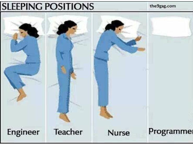


Top Tags
Weekly Rant
View